Secret Falls, Mt Wellington Park, Hobart – Tasmania, Australia

Tasmania’s worst kept secret.

Secret Falls are ‘hidden’ along the Myrtle Gully Track on the way to Myrtle Gully Falls. Head to Myrtle Gully Falls blog post to find out how to access the track.

To get to Secret Falls, I walked up the stairs on the Myrtle Gully Track and peered down at a steep riverbank (which when I visited was bone dry). But I could still hear the flow of Secret Falls which was promising.

To the left of the Myrtle Gully Track just before and just after the staircase, there are a number of ways to meander to Secret Falls.

I opted for what looked like a make-shift path (probably just created by water) from the top of the staircase. It was steep but the earth was smooth and there were lots of tree branches and tree trunks to use as an aid for stability.

When you can see water, that’s a good sign. Here’s the view of the not-so-river behind me:

And Secret Falls peep through a small crevice that resembles a gorge (though it’s only about 3 meters in height).

As you can see, they weren’t flowing much due to lack of rainfall, but they were still beautiful.

The sunlight trickled through from some unseen ‘above’, casting light over the greenery and the falls. The reflection danced in the pool of rocks and leaves below.

I’d love to see the difference of Secret Falls after heavy rain, but the thin misty trickle that I experienced was unique in itself.

From Secret Falls it’s a short walk to Myrtle Gully Falls, which I outline how to find here.

Quick Facts

Last visitJune 2017
Best TimeJuly-September 
Start / FinishEnd of Old Farm Road, located along the Myrtle Gully Track (not signed)
Unsealed RoadsYes, blind corners and potholes
Walking distance1km return 
Time10-15 minutes
DifficultyEasy 
FacilitiesNone, town 10 mins away 
Lat & Long42.8957° S, 147.2640° E
Nearby Myrtle Gully Falls
Watercourse Unknown

Want to subscribe?

Never miss out on a waterfall chase by entering your email below!

Recent Posts

Find me on Facebook

Myrtle Gully Falls, Mt Wellington Park, Hobart – Tasmania, Australia

It was my third day in Tassie.

I’d already seen five waterfalls (O’Grady Falls and Silver Falls in Mt Wellington and Russell Falls, Horseshoe Falls and Lady Barron Falls in Mt Field National Park) in two days, and I had three days to go.

I began my first solo journey in my little hire car (a Kia from Drive Car Rental, a review in the footnotes of Russell Falls blog post). I had the idea that I would drive right up to the beginning of the track to Myrtle Gully Falls – the Myrtle Gully Track, which can be accessed from Old Farm Road behind Cascades Brewery.

I began my journey from Liverpool Street in Hobart’s CBD, as I was staying at The Pickled Frog Backpackers (review in the footnotes of O’Grady Falls blogpost. If you’re more of a hotel person, try hotels.com for comparison prices). Driving directions to the Myrtle Gully Track are as follows:

  • Head South-West on Liverpool Street towards Murray Street
  • Turn left onto Murray Street
  • Use the right three lanes to turn right onto Davey Street/A6 and stay in the right lane, following this for 1.3kms
  • Turn right onto Southern Outlet/A6
  • Turn left onto Macquarie Street and follow for 2.3kms as it turns into Cascade Rd
  • Soon you’ll pass Cascades Brewery on the right (it will be very obvious, it’s a big factory)
  • Directly after the Brewery and carpark, turn right onto what’s labelled Old Farm Road, but here looks like an industrial area you’re not meant to drive on (don’t worry, you can). Just beware of trucks and machinery from the Brewery
  Old Farm Road winds behind Cascades Brewery. Google Maps (2017).

Here in the clearing there’s a blocked off road to the left, and the Cascades Walking Track also begins straight ahead. If you’re a keen hiker, you can find more information on this trail here.

Below you can see the beginning of the Cascades Track, and Old Farm Road continuing behind the Brewery – follow this.

  • Continue behind the Brewery along Old Farm Road and follow the road as it curves to the left up a small hill
  • This is ‘officially’ Old Farm Road – and it’s true to its name. It’s a very thin, single lane road that winds behind private farms and is a bit bumpy at times. Be careful going around blind bends and watch out for potholes in the road
  • Finally you’ll reach the end (it’s a No Through Road) with a small carpark off to the left
Old Farm Road becomes Old Farm Track and other trails begin. Google Maps (2017).

I stepped out of my little Kia into a crisp, cold air. Ahead of me was the end of Old Farm Road:

The Cascade Walking Track continues here, too.

I turned and took one last glance at Old Farm Road behind me:

And then I observed the hill that curves up to the right, where The Main Fire Trail also begins.

The Myrtle Gully Track begins fairly straight ahead. I adjusted my camera bag strap on my shoulder and began on the track.

Sign indicating Myrtle Gully Track.

The track is very short and the walk is easy.

A small staircase elevated slightly, but it wasn’t difficult. It was here that the sound of trickling water below me filled my ears.

That’s because Secret Falls flow almost underneath this track, down the river bank. Head to that blog post to see how to get to them.

Before long I reached a bridge which provides a viewing for the falls.

Unfortunately they were all but bone-dry when I visited. This was probably due to the lack of rainfall recently experienced by the region.

Thick, squishy moss covered the rock face. Water still trickled down intricately, soaking the moss through.

The lack of water meant that I could get right up close to the top tier of the waterfall, so that was pretty cool. Where I’m standing in the below photo would usually be flooded with fresh, flowing water.

It was disappointing, but not as disappointing as it would have been if I’d trekked a whopping, strenuous distance to reach them. Luckily I hadn’t come from the opposite direction deep inside Mt Wellington (refer to the map below to see the other trails).

The Myrtle Gully Track continues further up Mt Wellington and meets up with other tracks. Google Maps (2017).

The Myrtle Gully Track can also be reached if you begin hiking from further up Mt Wellington, though the walk would be much longer. The North-South Track in the above photo meets up with the Old Farm Fire Trail. I talk about this particular track in the O’Grady Falls blog post. If you’re a keen hiker, there’s some great information here.

As you can see, Myrtle Gully Falls were very dry. But it also allowed for some unique, close-up shots that I would never have otherwise got, and probably will never capture again.

There’s always a positive side to visiting falls.

It was very quiet and the air was cold and brisk. Make sure you wear warm clothes when visiting Mt Wellington.

Up above the mossy waterfall, a furry animal rustled in the ferns. I barely caught a glimpse of whatever it was, but it was awesome to know I was surrounded by wildlife.

It was disappointing that the falls weren’t flowing, sure, but it was still a great experience.

After Myrtle Gully Falls, I walked back the way I had come to try my hand at finding Secret Falls. Discover them with me!

Lastly, New Town Falls are also nearby, though I didn’t tackle the trek. Waterfalls of Tasmania have some good information if you’re keen on seeing them.

Myrtle Gully Falls in relation to New Town Falls, Mt Wellington. Google Maps (2017).

Quick Facts

Last visitJune 2017
Best TimeJuly-September after heavy rainfall
Start / FinishEnd of Old Farm Road
Unsealed RoadsYes, blind corners and potholes
Walking distance 1km return
Time 10-15 minutes
Difficulty Easy
FacilitiesNone, town 10 mins away
Lat & Long42.8955°S 147.2637°E 
NearbySecret Falls, Strickland Falls, Cascade Brewery
Watercourse Unknown

Want to subscribe?

Never miss out on a waterfall chase by entering your email below!

Recent Posts

Find me on Facebook

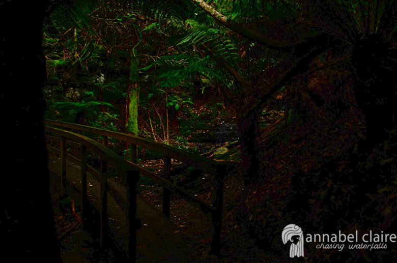
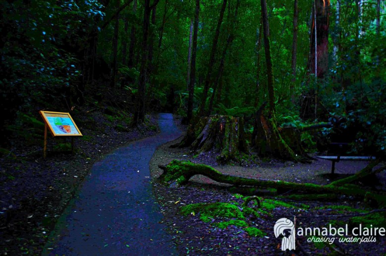
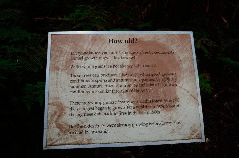
Lady Barron Falls, Mt Field National Park – Tasmania, Australia

The last stop on the Mt Field National Park circuit.

(Or, the first if you choose to begin the other way).

Myself and my new-found friends Ben and Yiwii from The Pickled Frog Backpackers (review in the footnotes of O’Grady Falls, if you prefer a hotel try Hotels.com) began our walk from Horseshoe Falls.

The walk from Horseshoe Falls to Lady Barron is the toughest and longest part of the waterfall circuit at Mt Field National Park. However, it’s still relatively easy. We started along a well-structured bridge.

And continued along a flat, easy boardwalk.

Huge fallen trees lay on either side of the track, laced in thick moss.

The track then begins uphill, though it’s not very strenuous.

The sunlight dazzled through the trees and lit up fluorescent green moss to create a beautiful landscape around us.

Don’t forget to look up at the gorgeous tall trees.

This track has plenty of diversity when it comes to scenery. The sun burst through a thick, fern forest and illuminated the track.

Along the walk to Lady Barron Falls there is the option to deviate along the Tall Trees Walk.

You would need to turn to the left in this small clearing for the Tall Trees Walk.

I was far too focused on waterfalls – as usual. So we continued straight ahead along the main path.

Blooming mushrooms sprung out from logs in bright orange and yellow.

There were also plenty of signs with information on the surrounding flora and fauna.

O’GRADY FALLS, MT WELLINGTON PARK, HOBART – TASMANIA, AUSTRALIAAs we walked through the forest, Ben had some gentle music playing from his portable speaker, which actually went really well with the scenery. I began to tell Ben and Yiwii about my walk to O’Grady Falls and how I kept coming across bridges, so I proclaimed it ‘the trail of bridges’ and then – I shit you not – we came across a bridge.

One minute you’ll be in thick, ferns and the next in wide open clearings with gorgeous tall trees. That’s what makes the hike so special.

I always make sure to read the signs along the way to soak in the history and information about the surroundings.

Another bridge peeped through the ferns and it became a running joke that every time a bridge appeared, everyone had to hang back while I took a photo.

It doesn’t sound that funny now, but we had a good old laugh at the time.

Another great little sign.

It felt like we had been walking for ages, when in reality it was only about 5 minutes. We still had 30 minutes to go.

The track turns skinny and muddy. If it had rained more recently then the track would be squishy and slippery. Soon you need to cross the road, so beware of any traffic.

We then headed back into thick forest with increasing amounts of moss.

The sun shone through again, creating a burst of different shades of green.

Another little bridge appeared.

The track thinned out again, and we wondered if we were getting any closer.

We then reached a man-made staircase, and with each step we began to hear the rush of water. I jumped with excitement. Finally we were close.

At the bottom of the stairs, the visitors centre can be reached one way, and Lady Barron Falls the other.

Russell Falls and the Tall Trees is back where we just came from.

We followed the sign for Lady Barron Falls.

And then we were walking beside the river bank, with lots of little cascades along the way. Though it wasn’t accessible from the track.

And at last – the falls.

There’s a small viewing platform to see Lady Barron Falls. The falls continue down stream from here with quite a force, so it seemed impossible to get closer.

But I took the risk, and lifted myself up over the right-side of the fence. I then had to hug a mossy, wet log in order to edge myself carefully across and onto the rock face. There was the very real possibility of slipping as my friends anxiously looked on.

In hindsight, it was probably not the best idea to try and tackle these falls. It’s a good reminder that waterfalls are unpredictable and you should never do anything that you’re not confident in doing, or that puts your life in danger.

I’m in no way, shape or form recommending anyone do what I did. Waterfall accidents often end in tragedy, and I wouldn’t do it again.

But I got back safe and sound. And I had some great friends to accompany me.

Our stomachs grumbled and we figured it was time to head back to the visitor centre. Because the track is a circuit, we didn’t head back the same way. We followed signs for the visitor centre. The walk was short – only 20 minutes or so – and flat.

Sign on left indicates Visitor Centre, right indicates Lady Barron Falls

Just when I thought it was super easy, we hit a huge staircase.

There were 249 stairs. Two hundred – puff – and forty – puff – nine – puff – stairs. Then we collapsed on the chair at the top. Exhausted, hungry and thirsty, we picked ourselves back up and continued through a stunning controlled-burn forest.

A Pro Tip/Key Takeaway that I wish someone told me: Beginning at the Lady Barron Falls track means that all the stairs you come across will be heading downhill instead of up. Although, there’s a pretty big climb at the beginning through the control-burned forest. So there’s that.

I think you just need to be prepared for exercise either way – and hey, my glutes will thank me later.

All in all the waterfall circuit took us about 1 hour of walking – we just took our time at each of the falls because of my excessive photography requirements. But it was a great day and I would recommend visiting all three.

OTHER: TO DO

After Mt Field National Park, we decided to drive to Richmond, another hour’s drive (and 30/40 minutes from Hobart). It has the oldest bridge in Australia still in use, and a very cute little strip of shops (including a sweets shop) and cafes (you must go to Czech cafe, it was warm and cute inside, and the food was delicious).

Richmond Bridge, the oldest still in use in Australia.

After Richmond we headed back towards Hobart. We were super keen to see the sunset – Tassie has amazing sunsets. We made our way down to the suburb of Bellerive along the water and had a view of Mt Wellington. It was beautiful, but super cold and windy so be sure to rug up!

Mt Wellington from Bellerive

Quick Facts

Last visit June 2017
Best Time July-September
Start / FinishMt Field Visitor Centre Carpark
Unsealed Roads No
Walking distance Waterfall circuit 2.4km from Horseshoe
Time Allow 2hrs for full circuit (about 40 -60 mins from Horseshoe Falls)
Difficulty Moderate
FacilitiesToilets, Cafe at Visitor Centre
Lat & Long42.6911° S, 146.6954° E
NearbyRussell Falls, Horseshoe Falls
Watercourse Lady Barron Creek

Want to subscribe?

Never miss out on a waterfall chase by entering your email below!

Recent Posts

Find me on Facebook

Horseshoe Falls, Mt Field National Park – Tasmania, Australia

Be prepared for stairs.

I’m just going to go right out and say that. While Horseshoe Falls are just a short distance (10 minutes or so) from Russell Falls on the Mt Field National Park waterfall circuit, the hike to them requires a bit of resilience.

LADY BARRON FALLS, MT FIELD NATIONAL PARK – TASMANIA, AUSTRALIAHorseshoe Falls are the second stop on the waterfall circuit at Mt Field. You will have to pass either Lady Barron Falls or Russell Falls first in order to get to them, depending which way you start. Check out those blog posts to figure out which would suit you best.

Myself and my hostel friends Ben and Yiwii from The Pickled Frog Backpackers (review in the footnotes of O’Grady Falls blog post , if you prefer a hotel try Hotels.com for comparison prices) began from Russell Falls. They ventured ahead of me, climbing up the stony stairs that zig-zag through the unique Tasmanian forest.

I didn’t count how many stone stairs there were, but there was a bench about half-way up, so that’s an indication that there’s enough stairs to require a rest. Safe to say I was huffing and puffing like my life depended on it. Well, it probably did.

Luckily the climb is made easier by the beautiful views you have surrounding you.

And then we hit the wooden stairs, of which there were 105. One hundred. And five. So yeah, be prepared for that, is all I’m saying.

The climb is well worth it, though. I had hoped it would lead to the top of Russell Falls, and I was right.

We were able to look out at the view from the river that flowed down into the falls we’d just been admiring minutes before. So that was pretty cool.

The river looked surprisingly small for the incredible flow at Russell Falls, but it was pretty nonetheless. It trickled by us with that classic, soothing sound of gentle water.

We continued on to Horseshoe Falls. Since the tracks are within a National Park, they’re well signposted. We laughed at the ‘1 minute’ engraved on the sign below. Almost doesn’t seem worth putting it there, does it?

Because sure enough, 1 minute later, we reached Horseshoe Falls.

As you can see, these falls get their name from the shape formed by the two sides of water flowing down into the river below. They were extremely luscious and green when we visited, which we relished. They’re not always like this, so consider this your disclaimer warning!

I was again able to practice my photography skills, enjoying the mossy green rocks I had to play with.

I then forced my new friends into taking photos of me once again. Well, actually they quite enjoyed it to be fair. In fact they were encouraging, and captured some killer ‘behind the scenes’ shots for me. They were legends.


Photo by @buzzpuppet

Photo by @buzzpuppet

As you can see, I set up the camera angle and adjusted the settings, making sure everything was perfect. The only real credit I can give to my new-found friends was them directing me on where to stand and how to pose. So I guess I have them to thank for that. Love you, guys!

I enjoyed Horseshoe Falls, though I wish they were flowing a little more to make that horseshoe shape more distinct.

We then began our journey to Lady Barron Falls, the longest and hardest part of the hike (which is still easy). Lady Barron Falls are 50 minutes from Horseshoe Falls and an hour from Russell Falls, with a Tall Trees walk on the way.

Quick Facts

Last visit June 2017
Best TimeJuly-September 
Start / FinishMount Field Visitor Centre 
Unsealed Roads No
Walking distance 1.2kms one way, circuit
Time 45 minutes one way, or 2hrs for circuit
DifficultyModerate, stairs involved
FacilitiesToilets & Cafe at visitor center
Lat & Long42.6763° S, 146.7116° E
NearbyRussell Falls and Lady Barron Falls (circuit)
Watercourse Russell Falls Creek

Want to subscribe?

Never miss out on a waterfall chase by entering your email below!

Recent Posts

Find me on Facebook

Image of Russell Falls taken on a chasing waterfalls trip in Tasmania

Russell Falls, Mt Field National Park – Tasmania, Australia

Image of Russell Falls taken on a chasing waterfalls trip in Tasmania

I was a little on the drunk side of sober.

Perched on a bar stool at The Pickled Frog Backpackers with my laptop in front of me, editing photos of O’Grady Falls and Silver Falls which I had visited just that day. I took a swig of my Cascades Pale Ale.

The next thing I knew, a bustle of people were filling the foyer, ordering drinks and giggling at the bar next to me. A short girl appeared to my right, leaned over to peer at my screen and exclaimed, “What are you doing?”

Soon enough, I had made friends with the small girl named Yiwii, who was from New York but travelling on from a business trip in Manilla. We were then joined by a guy called Ben, who was also from Melbourne. And by the end of the night, they’d both invited themselves on my next day trip to Mt Field National Park.

But I didn’t mind. Making new friends and having unexpected company with fellow travellers is one of the most fantastic things about travelling solo. So I welcomed them into my tiny little Kia, which I hired from Drive Car Rental (see footnotes for a full review), and off we went.

Photo by @yiwii featuring me and my Kathmandu backpack – so many great pockets for my essentials.

Driving to Mt Field from Hobart was easy – and the track to the falls begins from the Mt Field Visitor Centre. The drive took about an hour and a half and was relatively easy – even on the long, windy Tassie roads. To get there from Hobart City:

  • The easiest way to leave the CBD is by taking Brisbane Street to National Route 1
  • Continue on National Route 1 for 17.5km
  • Continue straight through the first roundabout – follow signs for Lyell Hwy A10 and follow this for 15kms
  • Continue straight at the next roundabout onto Lyell Hwy A10/Montagu Cres/A10 and follow for 1km
  • Continue straight at yet another roundabout onto Montagu St/B62 and follow this for 18kms
  • Then turn left onto Gordon River Rd B61 and follow this for 7.5kms
  • Turn right onto Lake Dobson Rd/C609 (this is the road entering into the Mt Field Visitor Centre)


The Mt Field Visitor Centre will cost you $24.00AUD entry (for a National Park Pass). You can drive in and park your car without any issues, but you will then need to purchase the pass from reception to put on your dash.

The walk to Russell Falls is one of the easiest in Tasmania. Once inside the Visitor Centre, head to the exit on the opposite side of the carpark, through the glass doors. You will be led to an obvious path, and see the sign above.

Shortly, a big blue sign leads the way. The waterfall track is a circuit of three falls including Horseshoe Falls and Lady Barron Falls. Obviously this means you can do the track the opposite way, too. If you’d like to do this, begin at the track for Lady Barron Falls, which can be accessed by following the road that passes the Mt Field Visitor Centre carpark (on foot). You’ll see the entrance quite clearly. Anyway, we began the easy way below:

The walk is flat and super easy, winding through a forest where bright green moss clings to everything in sight. Colourful, information signs are scattered along the track. I was extremely excited because this one below said that winter is the most likely time to see a platypus (I didn’t see one, sadly).

My new friends ventured ahead of me, through huge fallen trees.

There’s places to stop and sit along the way, although with the easy track I doubt you’d need to.

I always make sure to read the signs on the side of the track. You learn so much about the  place and the wildlife surrounding you.

Beautiful, green ferns danced around us and fluorescent green moss dazzled as it clung to fallen logs and rocks.

We took our time to stop and enjoy the wildlife, even though we were freezing in our thick, puffy jackets. It’s pretty cold up at Mt Field – in fact it gets layered with snow at times, so be sure to take appropriate gear and rug up!

We continued on – this track is only a 25 minute return so ‘continued on’ wasn’t actually that much further.

Another informative sign.

And then we made it!

Russell Falls had a big, wide, open viewing platform, and then a sneaky small platform off to the left where you could get closer to the falls (pictured below).

Russell Falls are about 34-58 meters in height (with 2 tiers/drops) and usually flow very well in winter/spring time. We were visiting in June, which would be considered prime-time, but Tassie was experiencing a severe lack of rainfall, so they weren’t flowing as much as they could have been.

They were still pretty beautiful though, with the incredible tiers/cascades providing excellent views and of course, photographs.

I think these were my favourite, to be honest. They’ve got to be up there. Their uniqueness and beauty captivated me.

And there I am, soaking in these gorgeous falls.

It was hilarious sharing my crazy passion for waterfalls with new friends, succumbing them to pressing the shutter release button on my camera for me. They did a pretty good job, don’t you think?

I almost didn’t want to continue on to Horseshoe Falls. Almost.

But it was time to move on. I took one last glimpse at these gorgeous falls which – fun fact – were first named Browning Falls when they were discovered in 1856. However, by 1884 tourists had flocked so frequently and they were re-named Russell Falls – the popular tourist attraction.

And then it was time to make our way to Horseshoe Falls, and later Lady Barron Falls.

Footnotes

I hired a small car from Drive (also known as Rent For Less) Car Hire, which is located on Harrington Street in Hobart CBD. My experience was really great – though my advice would definitely be to book online rather than walking in. It is significantly cheaper to book online. This was also the cheapest car hire I could find, and the location in the CBD made it even easier in terms of accessibility.

Lucky for me The Pickled Frog Backpackers had free parking. A review of this hostel can be found in the footnotes of the post on O’Grady Falls.

Quick Facts

Last visit June 2017
Best Time July-September
Start / FinishMount Field Visitor Center
Unsealed Roads No
Walking distance 500meters return (wheelchair accessible). Full circuit 
Time 25 min return (unless  circuit)
Difficulty Super Easy
Facilities Toilets
Lat & Long 42.6772° S, 146.7129° E
NearbyCircuit continues to Horseshoe Falls and Lady Barron Falls
Watercourse Russell Falls Creek

Want to subscribe?

Never miss out on a waterfall chase by entering your email below!

Recent Posts

Find me on Facebook