An image of a girl in a kimono and hat looking out to azure blue waters of Black Diamond Lake

Black Diamond Lake, Collie – Western Australia

HOW TO FIND BLACK DIAMOND LAKE & TIPS BEFORE YOU GO

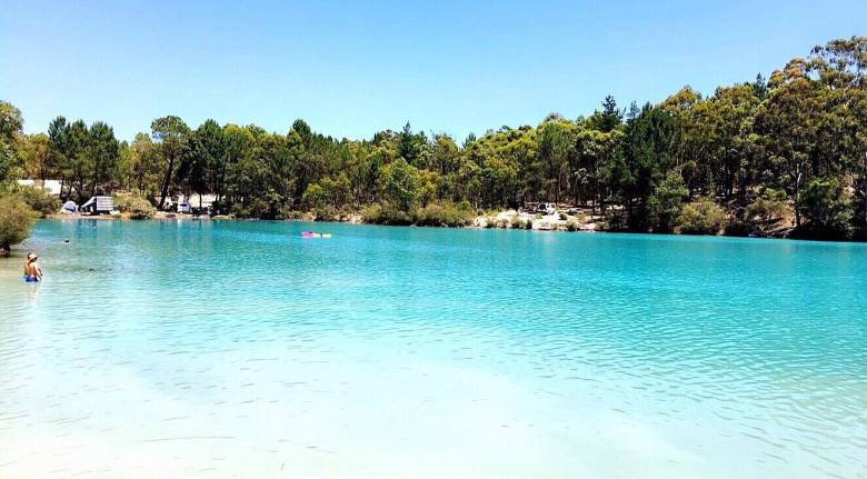
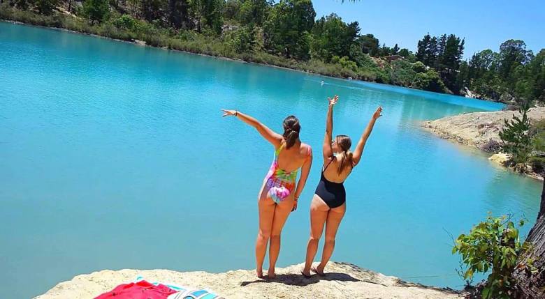
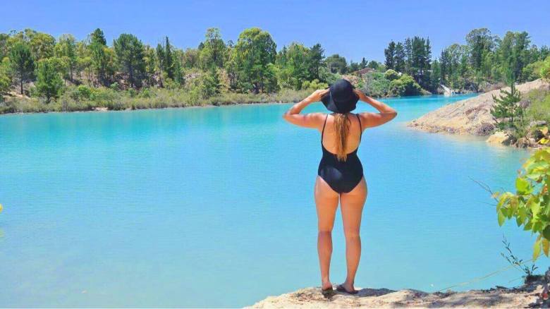
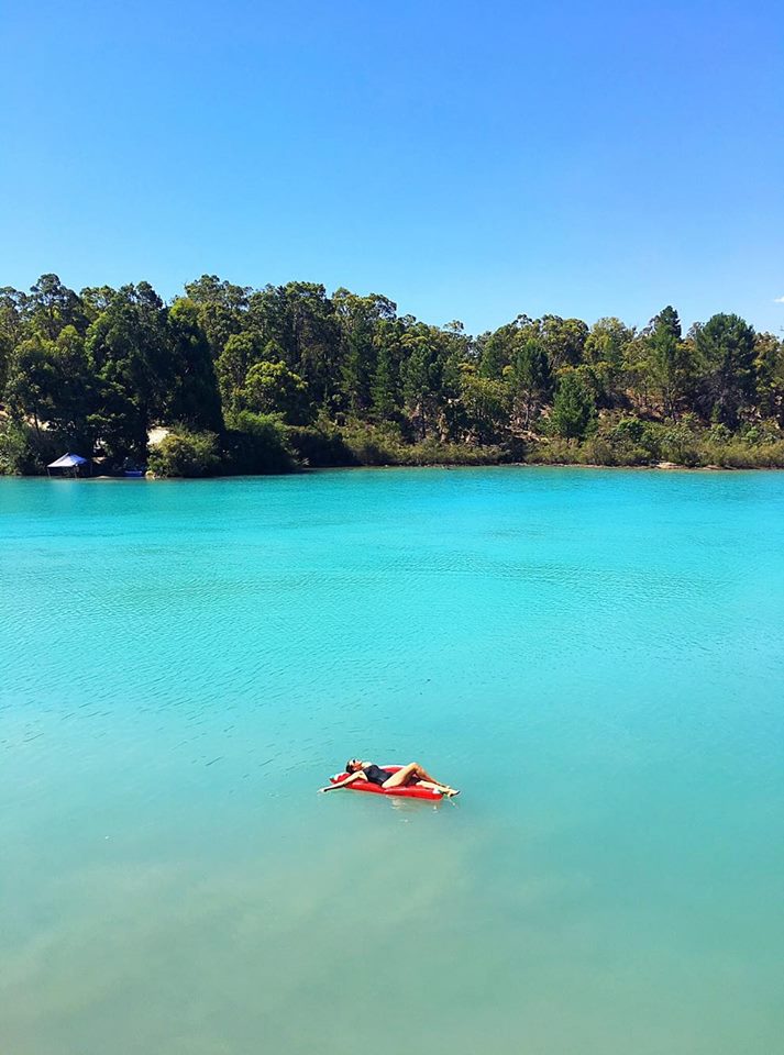
Ever since I saw a photograph of the pristine, bright crystal-blue water of Black Diamond Lake, I wanted to go there.

I mean, look at it.

15991725_10210402590313939_1485170358_o

Friends and I talked about going to Black Diamond Lake, throwing around ideas about road trips and camping trips and the works, but of course, they never actually got put into motion.

While holidaying in Australia’s South West, I decided to change that. I sent my friend Morgan the message – something along the lines of “WE STILL HAVE TO GO TO BLACK DIAMOND LAKE – BEFORE I GO!!!” And Morgz, being the enthusiastic person that she is, said ‘Yep, what about Thursday?’ And that was that.

15978176_10210402591233962_1404490344_n

Black Diamond Lake is located in Allanson, a community only 5km or so from the town known as Collie, roughly 190km from Perth.

Morgan drove down from Perth, and I drove up from Busselton. My trip was an hour and a half, while hers 2 hours or so. Either way, the lake isn’t too difficult to get to – Ferguson Road, the road the lake resides by, comes directly off Coalfields Highway, so there’s not a lot of fluffing about in small country-town roads.

Screen Shot 2017-01-16 at 2.26.52 PM.png
Road Map. Black Diamond Lake, Allanson. Google Maps (2017).

I actually visited Black Diamond on the same day I did Barrabup Pool, so I won’t go into the details of the way I went. But if you’re traveling from Perth, take Kwinana Freeway South until it turns into Forrest Highway and eventually continue onto Old Coast Road. Then turn left onto Raymond Road, which you follow until you hit South Western Highway, at which point turn left and then a quick right into Coalfields – and then you’re on your way to Ferguson!

Screen Shot 2017-01-16 at 2.26.27 PM.png
Road Map. Raymond Road to Coalfields Highway. Google Maps (2017).

Once you’ve turned into Ferguson (a right turn onto an unsealed road), keep following for about 600m and you’ll see the first glimpse of the lake. Continue until you come to the first carpark on the right (it will be very obvious). There is lots of parking space there and easy access into the lake.

15967568_10210402591153960_37477852_o

For those that don’t know, Black Diamond was formerly an open cut mine site that ceased operation in the 1950s and has since been filled with water.

Now it is probably at this point that I should mention the danger of the presence of amoeba in the water. There have been a few warnings issued about the water quality at Black Diamond – all the information you need can be found on the council’s report and also an article by WA today. (FYI, I put my head under the water and I’m still here kicking).
However, it is best to have all the info and make your own educated decision before you go.

I would recommend going on a really sunny, cloudless day, because this is when the water will look its best, shining the beautiful azure blue colour.
15992014_10210402590713949_464154993_o

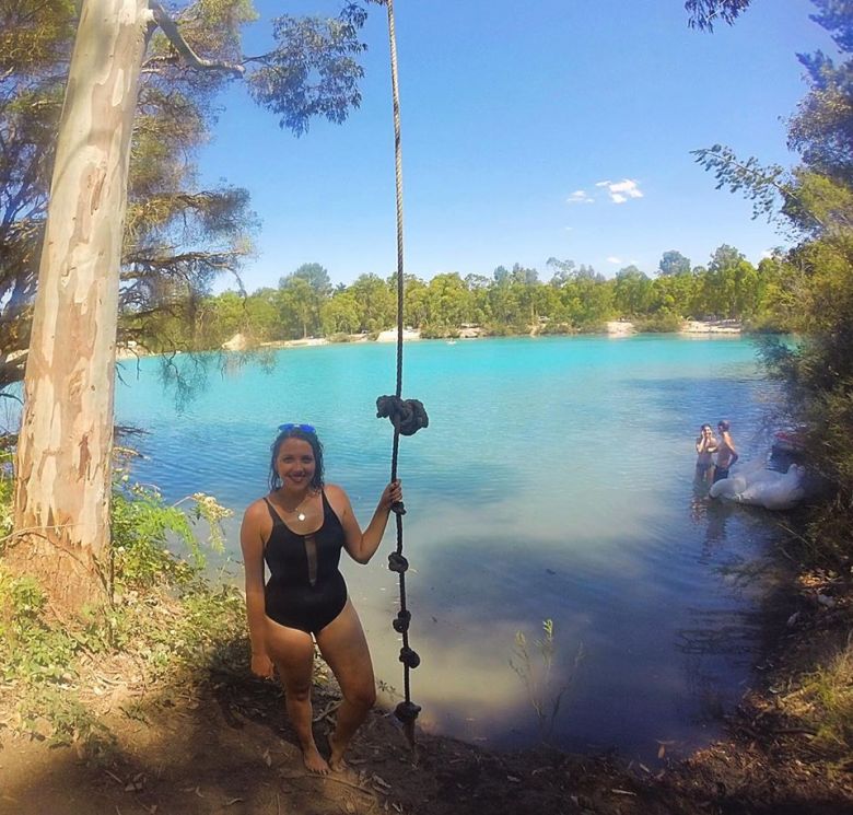
On the opposite side of the lake to the carpark, there’s a rope swing tied to a big tree. We couldn’t help ourselves – we had to have a turn. Though I would advise to jump directly straight and land on your feet, as it is very shallow on either side of this bank (and only if you’re willing to put your head under).
15978508_10210402594674048_505383986_n

In terms of picnicking, the best idea I’ve seen was those who took tarps to use as shades between two cars (generally utes, but you could make do), or small tents, picnic rugs and tables and chairs. There’s not a lot of shade space at the lake, so get creative with your choice of gear and remember to Slip, Slop, Slap!
16010618_10210402597114109_1242520635_o

We made a full day-trip out of being at the lake. Eskies, rugs, you name it. It was such a beautiful setting, even just to sit and observe.

We found a limestone rock to set up our stuff on, rather than being down on the bank with everyone else around us. The rock gave us a higher view of the lake, but not so high that we couldn’t easily enter the water. It was the perfect setting.
15967702_10210402596754100_1343772317_o

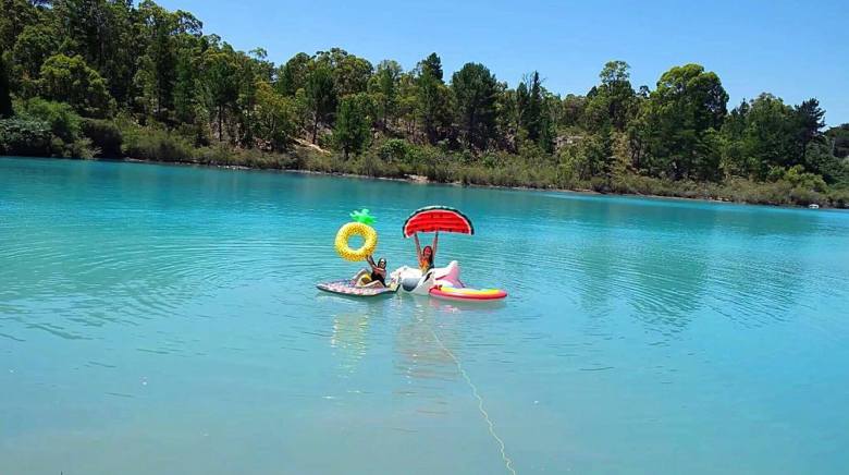
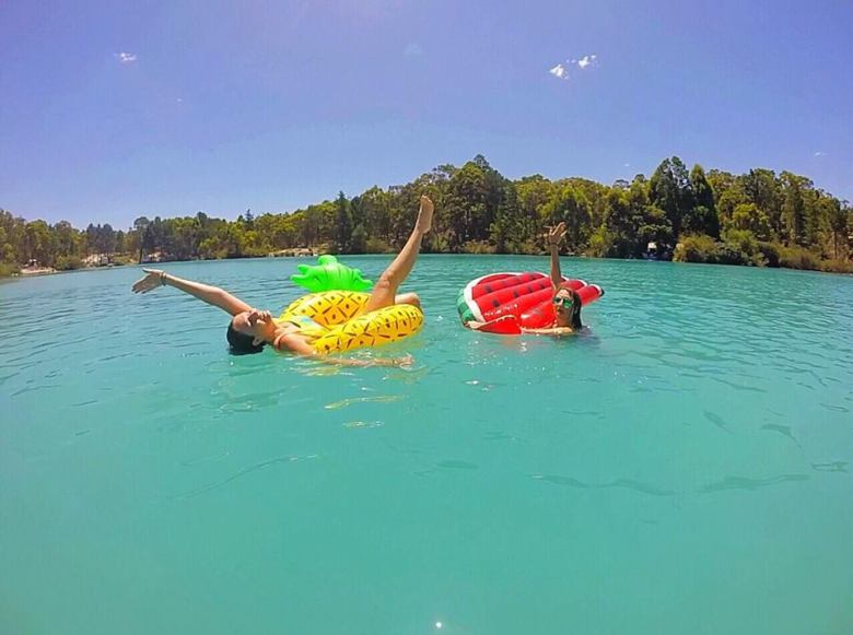
It was a scorching 37 degrees (probably more in direct sunlight) on the day that we went, so we escaped into the cool water, lounging around on blow-up mattresses, watermelons, pineapples and various birds for most of the time.
16009782_10210402595834077_305343485_o

15995502_10210402595314064_919404181_n

15991357_10210402596034082_58684684_o

Would you believe me if  I said that photos don’t even do this place justice?

It is another one of this world’s wonders that is worth seeing – especially when we don’t know how long we will be able to continue to visit, swim and enjoy the lake for.

I’m glad we made the trip.
15978604_10210402591353965_2039035381_n

Quick Facts

Last visitDecember 2018
Best TimeSeptember – March
Start / FinishFerguson Road
Unsealed RoadsYes, good condition can be managed in 2WD.
Walking distanceless than 100m from carpark
Time3hr drive from Perth
DifficultyEasy
FacilitiesNone
Lat & Longn/a
NearbyBarrabup Pool, Collie town
Watercoursen/a
Want to Subscribe?

Never miss out on an adventure by entering your email below!

Kathmandu

Horseshoe Falls, Mt Field National Park – Tasmania, Australia

Be prepared for stairs.

I’m just going to go right out and say that. While Horseshoe Falls are just a short distance (10 minutes or so) from Russell Falls on the Mt Field National Park waterfall circuit, the hike to them requires a bit of resilience.

LADY BARRON FALLS, MT FIELD NATIONAL PARK – TASMANIA, AUSTRALIAHorseshoe Falls are the second stop on the waterfall circuit at Mt Field. You will have to pass either Lady Barron Falls or Russell Falls first in order to get to them, depending which way you start. Check out those blog posts to figure out which would suit you best.

Myself and my hostel friends Ben and Yiwii from The Pickled Frog Backpackers (review in the footnotes of O’Grady Falls blog post , if you prefer a hotel try Hotels.com for comparison prices) began from Russell Falls. They ventured ahead of me, climbing up the stony stairs that zig-zag through the unique Tasmanian forest.

I didn’t count how many stone stairs there were, but there was a bench about half-way up, so that’s an indication that there’s enough stairs to require a rest. Safe to say I was huffing and puffing like my life depended on it. Well, it probably did.

Luckily the climb is made easier by the beautiful views you have surrounding you.

And then we hit the wooden stairs, of which there were 105. One hundred. And five. So yeah, be prepared for that, is all I’m saying.

The climb is well worth it, though. I had hoped it would lead to the top of Russell Falls, and I was right.

We were able to look out at the view from the river that flowed down into the falls we’d just been admiring minutes before. So that was pretty cool.

The river looked surprisingly small for the incredible flow at Russell Falls, but it was pretty nonetheless. It trickled by us with that classic, soothing sound of gentle water.

We continued on to Horseshoe Falls. Since the tracks are within a National Park, they’re well signposted. We laughed at the ‘1 minute’ engraved on the sign below. Almost doesn’t seem worth putting it there, does it?

Because sure enough, 1 minute later, we reached Horseshoe Falls.

As you can see, these falls get their name from the shape formed by the two sides of water flowing down into the river below. They were extremely luscious and green when we visited, which we relished. They’re not always like this, so consider this your disclaimer warning!

I was again able to practice my photography skills, enjoying the mossy green rocks I had to play with.

I then forced my new friends into taking photos of me once again. Well, actually they quite enjoyed it to be fair. In fact they were encouraging, and captured some killer ‘behind the scenes’ shots for me. They were legends.


Photo by @buzzpuppet

Photo by @buzzpuppet

As you can see, I set up the camera angle and adjusted the settings, making sure everything was perfect. The only real credit I can give to my new-found friends was them directing me on where to stand and how to pose. So I guess I have them to thank for that. Love you, guys!

I enjoyed Horseshoe Falls, though I wish they were flowing a little more to make that horseshoe shape more distinct.

We then began our journey to Lady Barron Falls, the longest and hardest part of the hike (which is still easy). Lady Barron Falls are 50 minutes from Horseshoe Falls and an hour from Russell Falls, with a Tall Trees walk on the way.

Quick Facts

Last visit June 2017
Best TimeJuly-September 
Start / FinishMount Field Visitor Centre 
Unsealed Roads No
Walking distance 1.2kms one way, circuit
Time 45 minutes one way, or 2hrs for circuit
DifficultyModerate, stairs involved
FacilitiesToilets & Cafe at visitor center
Lat & Long42.6763° S, 146.7116° E
NearbyRussell Falls and Lady Barron Falls (circuit)
Watercourse Russell Falls Creek

Want to subscribe?

Never miss out on a waterfall chase by entering your email below!

Recent Posts

Find me on Facebook

Image of Russell Falls taken on a chasing waterfalls trip in Tasmania

Russell Falls, Mt Field National Park – Tasmania, Australia

Image of Russell Falls taken on a chasing waterfalls trip in Tasmania

I was a little on the drunk side of sober.

Perched on a bar stool at The Pickled Frog Backpackers with my laptop in front of me, editing photos of O’Grady Falls and Silver Falls which I had visited just that day. I took a swig of my Cascades Pale Ale.

The next thing I knew, a bustle of people were filling the foyer, ordering drinks and giggling at the bar next to me. A short girl appeared to my right, leaned over to peer at my screen and exclaimed, “What are you doing?”

Soon enough, I had made friends with the small girl named Yiwii, who was from New York but travelling on from a business trip in Manilla. We were then joined by a guy called Ben, who was also from Melbourne. And by the end of the night, they’d both invited themselves on my next day trip to Mt Field National Park.

But I didn’t mind. Making new friends and having unexpected company with fellow travellers is one of the most fantastic things about travelling solo. So I welcomed them into my tiny little Kia, which I hired from Drive Car Rental (see footnotes for a full review), and off we went.

Photo by @yiwii featuring me and my Kathmandu backpack – so many great pockets for my essentials.

Driving to Mt Field from Hobart was easy – and the track to the falls begins from the Mt Field Visitor Centre. The drive took about an hour and a half and was relatively easy – even on the long, windy Tassie roads. To get there from Hobart City:

  • The easiest way to leave the CBD is by taking Brisbane Street to National Route 1
  • Continue on National Route 1 for 17.5km
  • Continue straight through the first roundabout – follow signs for Lyell Hwy A10 and follow this for 15kms
  • Continue straight at the next roundabout onto Lyell Hwy A10/Montagu Cres/A10 and follow for 1km
  • Continue straight at yet another roundabout onto Montagu St/B62 and follow this for 18kms
  • Then turn left onto Gordon River Rd B61 and follow this for 7.5kms
  • Turn right onto Lake Dobson Rd/C609 (this is the road entering into the Mt Field Visitor Centre)


The Mt Field Visitor Centre will cost you $24.00AUD entry (for a National Park Pass). You can drive in and park your car without any issues, but you will then need to purchase the pass from reception to put on your dash.

The walk to Russell Falls is one of the easiest in Tasmania. Once inside the Visitor Centre, head to the exit on the opposite side of the carpark, through the glass doors. You will be led to an obvious path, and see the sign above.

Shortly, a big blue sign leads the way. The waterfall track is a circuit of three falls including Horseshoe Falls and Lady Barron Falls. Obviously this means you can do the track the opposite way, too. If you’d like to do this, begin at the track for Lady Barron Falls, which can be accessed by following the road that passes the Mt Field Visitor Centre carpark (on foot). You’ll see the entrance quite clearly. Anyway, we began the easy way below:

The walk is flat and super easy, winding through a forest where bright green moss clings to everything in sight. Colourful, information signs are scattered along the track. I was extremely excited because this one below said that winter is the most likely time to see a platypus (I didn’t see one, sadly).

My new friends ventured ahead of me, through huge fallen trees.

There’s places to stop and sit along the way, although with the easy track I doubt you’d need to.

I always make sure to read the signs on the side of the track. You learn so much about the  place and the wildlife surrounding you.

Beautiful, green ferns danced around us and fluorescent green moss dazzled as it clung to fallen logs and rocks.

We took our time to stop and enjoy the wildlife, even though we were freezing in our thick, puffy jackets. It’s pretty cold up at Mt Field – in fact it gets layered with snow at times, so be sure to take appropriate gear and rug up!

We continued on – this track is only a 25 minute return so ‘continued on’ wasn’t actually that much further.

Another informative sign.

And then we made it!

Russell Falls had a big, wide, open viewing platform, and then a sneaky small platform off to the left where you could get closer to the falls (pictured below).

Russell Falls are about 34-58 meters in height (with 2 tiers/drops) and usually flow very well in winter/spring time. We were visiting in June, which would be considered prime-time, but Tassie was experiencing a severe lack of rainfall, so they weren’t flowing as much as they could have been.

They were still pretty beautiful though, with the incredible tiers/cascades providing excellent views and of course, photographs.

I think these were my favourite, to be honest. They’ve got to be up there. Their uniqueness and beauty captivated me.

And there I am, soaking in these gorgeous falls.

It was hilarious sharing my crazy passion for waterfalls with new friends, succumbing them to pressing the shutter release button on my camera for me. They did a pretty good job, don’t you think?

I almost didn’t want to continue on to Horseshoe Falls. Almost.

But it was time to move on. I took one last glimpse at these gorgeous falls which – fun fact – were first named Browning Falls when they were discovered in 1856. However, by 1884 tourists had flocked so frequently and they were re-named Russell Falls – the popular tourist attraction.

And then it was time to make our way to Horseshoe Falls, and later Lady Barron Falls.

Footnotes

I hired a small car from Drive (also known as Rent For Less) Car Hire, which is located on Harrington Street in Hobart CBD. My experience was really great – though my advice would definitely be to book online rather than walking in. It is significantly cheaper to book online. This was also the cheapest car hire I could find, and the location in the CBD made it even easier in terms of accessibility.

Lucky for me The Pickled Frog Backpackers had free parking. A review of this hostel can be found in the footnotes of the post on O’Grady Falls.

Quick Facts

Last visit June 2017
Best Time July-September
Start / FinishMount Field Visitor Center
Unsealed Roads No
Walking distance 500meters return (wheelchair accessible). Full circuit 
Time 25 min return (unless  circuit)
Difficulty Super Easy
Facilities Toilets
Lat & Long 42.6772° S, 146.7129° E
NearbyCircuit continues to Horseshoe Falls and Lady Barron Falls
Watercourse Russell Falls Creek

Want to subscribe?

Never miss out on a waterfall chase by entering your email below!

Recent Posts

Find me on Facebook

Olinda Falls, Dandenong Ranges National Park, Melbourne – Victoria, Australia

It was a Saturday morning.

My schedule? Assignments, assignments, and OH YEAH – more assignments. It was not in the plan to even leave the house. 

I peered longingly out of my bedroom window. It was sunny outside, a rare occurrence at this time of the year in Melbourne. Extremely rare. In fact, it almost never happened…

So, I made a split-second decision.

“Stuff it,” I thought, “It’s such a beautiful day, I’m not going to waste it.”

So, I put on my hiking gear and I packed a bag, locked the door behind me, and off I went on my adventure.

And an adventure it was. You see, I don’t own a car. That’s because I live in Melbourne and the public transport here is pretty good. That is, if you’re just travelling within the city. Where I was headed – the Dandenong Ranges – was practically the country-side.

SPOILER ALERT: I made it. Lol.

It took me (from Brunswick):

  1. The 19 tram from Brunswick Road/Sydney Road to Melbourne Central Station.
  2. The Lilydale Train line to Croydon (21 stops).
  3. The 688 Bus to ‘Upper Fern Tree Valley’ from Stop 6 outside Croydon station (which was actually super easy to find), then getting off after 37 stops. Thirty Seven! At Dandenong Tourist Road/Falls Road. Make sure to look up the latest routes on Public Transport Victoria, or download the PTV app.
  4. A 1.1km walk down a tremendous hill that is Falls Road (which I forgot I was going to have to walk back up. Ha. Ha. Ha….)
  5. I arrived! With total travel time at 2hrs 11minutes. The above photograph is outside the carpark – the track to the falls is off to the left.

There’s a lovely little picnic area here, as well as plenty of signage to help you on your way. I forgot to get a photograph of the map because a group of tourists were milling around it when I arrived, so I figured I’d get the shot on the way back. Of course, I forgot. Sorry everyone.

There’s also toilet facilities, which aren’t drop toilets but are still pretty dismal, and which only had freezing cold tap water.

The track to the falls is quick (roughly 300m), and all downhill.

Off I went, through an array of gorgeous Karri trees.

There are also a number of other walking tracks in this area for those that are keen hikers. Me? I’ll only hike if it will find me a waterfall. But if you want more information on the hikes in area, you can click here.

Then I reached the fork in the road with the track to the Lower Falls one way and the Upper Falls the other. You’d think my heart would’ve sunk at the sight of the fence blocking off the Lower Falls track, wouldn’t you?

In actual fact, I didn’t even bat an eyelid. I knew full well I’d be going down there regardless. I didn’t come all this way for nothing. But I decided to check out the Upper Falls first.

On the short walk to the Upper Falls, a little path had formed itself down the river bank. I knew I’d be scooting on down there, too. However, a little further along there’s a viewing platform, from which you can get some pretty gorgeous shots, too.

Still, typical me found my way as close to the water as humanely possible. I can imagine that in the crux of winter, it would be impossible to walk across the rocks like I did. At this time (May on the cusp of June) it was relatively tame.

I spent quite a bit of time meandering across the rocks to get some shots at different angles. It was a very peaceful day, with not too many people around, so I wasn’t disrupting anyones photographs.

I then decided it was time to venture further into the ‘exclusion zone’. I had planned to walk back up the path and squeeze past the fence, but a fallen log near the platform lookout of the Upper Olinda Falls allowed access to the blocked-off path. I wobbled across it and appeared with a view of the fence behind me. I know – #DareDevil #Rebel

There was a steep descent ahead of me, and I felt my heart clanging around in my chest. What challenge awaited me? Why had the path been blocked off? I was about to find out.

It was a bit anti-climatic, really. I thought I was going to have to scramble over huge fallen trees and debris and stuff. Turns out it was just the side railing that had been destroyed. The path itself was fine. I know, boring right?

Tis’ pretty hectic damage, though. But I continued on just fine without the aid of the railing. I guess if it had been a wet, rainy day it would’ve been more dangerous. Travel at your own risk, I guess.

Before long I came to a fork in the road – which was actually three seperate paths, marked with a wooden stool, a big tree and more hand-railing.

Path number 1 veers off to the right:

Path number two veers off to the left, down some steps which are just planks of wood and then mud:

And path number three, which isn’t really a path, so much as it is a slope made clean by rainwater, is straight ahead:

I decided to veer right first, in an attempt to get closer to the Upper Falls. I had peered down at them from the top viewing platform, aching to go further down and get better angles for photos. I hoped this path would lead me there.

Success! I managed to find the endless cascades of the Upper Falls, and a thin path along the right of the river bank made it easy to walk along and get closer.

As you can imagine, with heavy rainfall in the midst of winter this may not be accessible. It kind of reminded me of The Lion King 2, when the river suddenly gushes and fills with water, covering everything in its path. But luckily for me, my fate was less drastic than Zira’s. If you don’t know what I’m talking about, you need to go and watch The Lion King 2 right now. Like seriously, quit reading this and go watch it.

Anyway, then I ventured back to the fork in the road (where the wooden seat was) and tackled the path that wasn’t really a path, slipping and sliding my way down (literally, this was dangerous so be very careful if you plan on doing this).

The difficulty was rewarding, however, when I reached some mini-falls. These were probably my favourite along the entire bank.

Now, because I still haven’t invested in a tripod (give me a break – I’m a broke uni student!), I had to rest my camera precariously on slippery rocks. It actually almost slid off once, but I caught it. Thankfully. The mini heart-attack I had when that happened was enough for me to give up on the photographs.

However, before that little incident, I managed to capture some shots on self-timer.

I look pretty relaxed, hey? Haha don’t be fooled – my camera’s self-timer only allows up to 10 seconds of delayed photography, so I had to sprint (on slippery mud) and leap over the rock on the right-hand side – yeah, the one covered in the green moss – in order to get to that spot.

Green mossy rock^^

And there I am wearing my Lu Lu Lemon Top which makes me look like I have horrendous back-fat. But IT’S FINE. I GOT THE PHOTO. Anyway this was the last shot I took before I almost lost my camera down the stream of freezing water, so I made my way back up to the main path.

P.S. If anyone wants to be my hiking/waterfall buddy and take aesthetic photos of me, don’t be shy! Enquire within.

I then started the short journey to the Lower Falls along a thin, muddy path. All in all, the difficulty rating of this track is relatively easy.

I continued on, down a windy section of the path that veered around to the right and opened up into the Lower Falls platform.

It was peaceful, seeing as the path was blocked off, and I had the place to myself.

As you can see, the falls keep going further downstream. I wondered what they look like from here on. But the access ends here, so I will never know. Luckily, the Lower Falls were beautiful and distracted me.

I rested my camera on the ledge of the platform to achieve these shots (don’t worry, this time I kept the strap around my neck and didn’t abandon the camera, so there was no chance of it falling to a cold, wet death).

Again, further up there were some more mini-falls. I simply loved experimenting with photos, and taking in all the beautiful surroundings and the different nooks and crannies of this waterfall. I really am surprised they don’t refer to them as cascades.

Overloading you with photographs just to try and spark some inspiration in you. I highly recommend going to visit!

Plus the Dandenong Ranges itself is a beautiful area of Victoria. I felt the air turn chilly and crisp the moment I arrived. But it was amazing – clean, fresh air free from all the city’s pollution. I was relieved to be free of cigarette smoke, if even for a little bit.

Quick Facts

Last visit May 2017
Best Time June-October
Start / FinishDandenong Ranges National Park Carpark
Unsealed Roads No
Walking distanceUpper 350meters Lower 500meters
Time 1hr return
Difficulty Moderate
Facilities Picnic tables, Toilets
Lat & Long 37.8341° S, 145.3700° E
NearbyDandenong Ranges Botanic Gardens
Watercourse Olinda Creek

Want to subscribe?

Never miss out on a waterfall chase by entering your email below!

Recent Posts

Find me on Facebook

Sheoak Falls, Great Ocean Road, Lorne – Victoria, Australia

My muscles were aching.

I stretched back in the driver’s seat and pushed my foot on the accelerator. I was determined to get to Sheoak falls – the second falls of the day – before sunset.

My friend Morgan and I had exhausted ourselves visiting Erskine Falls earlier in the day, but I wasn’t about to let that get the better of me. Our shoes were muddy and wet, laid out on my rain jacket in the boot, leaving us in soaked-through socks. Our hair was mangled onto our foreheads, my jeans were filthy, and I was starving, but we ventured on.

The view from a stopping bay on Great Ocean Road, Lorne.

The sun was already beginning to set, which made me anxious. But it made for a very pretty drive along Great Ocean Road, and Sheoak falls are only 5km from Lorne (we were staying at Lorne Foreshore Caravan Park), so in reality we had plenty of time. Or so I thought.

Directions to Sheoak Falls:
If you type “Sheoak Falls” into Google, it will tell you they’re right next to the carpark, as per the below.

Sheoak Falls Carpark. Google Maps (2017).

However, they’re actually more like where I’ve put the location tag in the image below. The carpark comes straight off Great Ocean Road, though, so it’s not hard to find your starting point.

Road Map. Google Maps (2017).

We soon came across the small car park off to the right (which is well sign-posted). However, once we were there, it wasn’t obvious which direction would actually lead us to the falls. Then we found the sign below, next to a mulch track off to the left.

I’d also heard Sheoak Falls were fairly easy to access, so we decided to hedge our bets. We jammed our feet back into our muddy shoes, waved goodbye to little Suzie and headed uphill on the mulch track.

The view of the carpark from the track (behind us).

Turns out I had heard correctly, and it was a pretty easy and basic track along a wooden boardwalk through shrubs and bush. My feet made the wood creak as I plodded along in the chilly air, taking in my surroundings.

The great, unique thing about these falls is having a view of the ocean as you walk. With green cliff scenery on one side, and the windy road with turquoise sea on the other, we were quite content.

It doesn’t last forever, though, and soon we had to deviate down some stairs and inland towards the falls.

We began the descent, taking each step slowly and one-at-a-time. And just as well – my heart nearly leapt out of my throat when I placed my foot on the 12th step from the bottom, which ricocheted forwards. I stumbled down the next few steps, but regained my balance without face-planting. Luckily.

It was minuscule in the scheme of things, but it made me giggle. This is one of the reasons I write my blog – to give people the tips and tricks they would never get from a National Park website. So, yeah, beware of the 12th step from the bottom! *Update* As at September 2017, this has been fixed.

Once I had tackled ‘death by wobbly step’, we reached a long, skinny concrete path that leads into the valley.

I’m quite surprised at how quickly we walked, considering how tired we were from all the day’s adventures (which you can read more about here). But time was of the essence and we wanted to make it to the falls before the sun disappeared behind the cliffs and left us in darkness.

Not to mention without the ability to take photos – I know! Disaster, right? If we couldn’t take pics – how would anyone know that we went!? It’s sad, but true. Ah, but really we just like to capture the beauty. Check out my Instagram for more!

So anyway, when we were faced with more stairs, we only moaned a little before charging upwards. What’s that saying? When the going gets tough, the tough gets going?

Still, the track to these falls is relatively simple and the stairs do exist for your aid. I just have a thing about stairs. My glutes twinged with each step, tightening almost to the point of cramping. I have a love/hate relationship with the feeling. I mean, on one hand you know it’s helping tone those butt-muscles we all want so badly. But on the other, well, it bloody hurts!

We made it, though. If even through clenched teeth. As you can see, these falls are not as commercialised as some of the others in the area, which makes them pretty special.

The uncommercialisegd, basic-as track I'm talking about.

Suddenly, we could see a glimpse of the falls peaking through the trees, and I got excited, clapping and carrying on.
“I can spy the falls, I see the falls, I’m going to some falls,” I chanted to Morgan. She just laughed at me in response.

It’s kind of childish how giddy I get when I see how close we are to flowing water, but I’m not ashamed. It’s part of what makes me who I am.

The view of the river from above.

Not long after seeing a glimpse of the falls, we reached a fork in the road. You can choose to head to the top of the falls or the bottom – though it’s not sign posted (bit obvious though, right?)

Seeing as we were quickly running out of daylight – I swear the sun is running a race when it begins to set – we decided to head downhill. It was a good choice. To read more about what’s up the stairs, Swallow Cave Falls, click here.

The bottom of these falls is an intimate area surrounded by gorge, which creates a stunning little hub to admire and take the photographs we so desperately wanted.

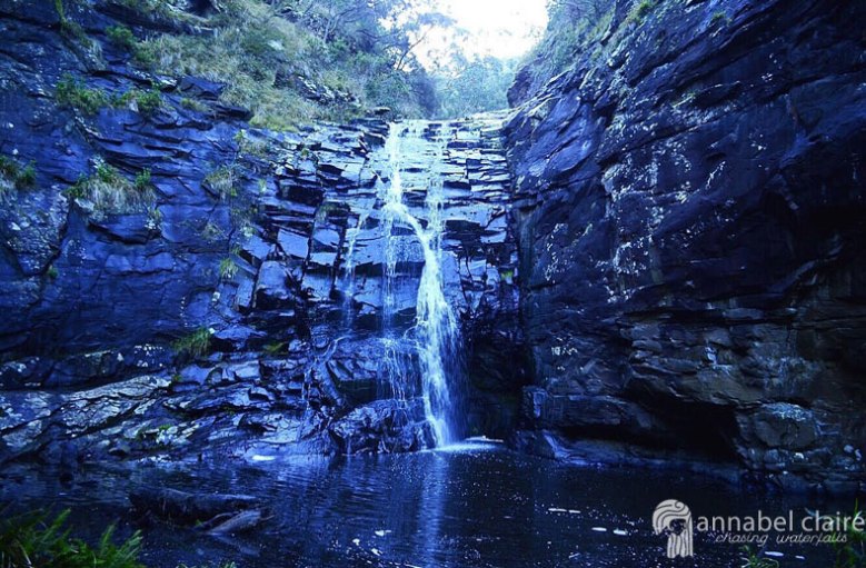
The air was completely still. It was crisp. There was nothing but the sound of the water running down the rock face. Green ferns bloomed at the water’s edge, which was murky and deep. I let out a sigh at its beauty.

Turns out the loss of sunlight was actually a great thing, because it allowed for some stunning photos tinged with hues of blue, and without the glare of the sun behind the rocks.

Now here’s where my craziness creeps in. I brought my favourite Wittner knee-high boots with me in order to get the perfect ‘Instagram’ shot. It’s absurd, really, how we all struggle to do something different for social media. I mean, what are we trying to prove? Well, ultimately that we are trendy and can take cool pictures. But to be honest with you, I just really like my boots.

I’m thinking Wittner should hire me as their model though, right? Just kidding.

Really this was the ultimate test to see how well I could balance and hop on squelchy mud without ruining suede. Risky, but fun.

I enjoyed the fact that different angles gave different lighting and mood to the pictures of these falls. I could’ve admired them forever.It was so quiet and peaceful in the gorge, especially since we had ventured out so late. This was at about 5.30pm, so we had the place all to ourselves.

After taking the time to simply admire the falls, I decided to explore further.

I love to get as close to waterfalls as humanely possible. This usually consists of diving right into freezing pools, or sitting directly under the falls themselves. However, it was literally way too cold for any such business during this time in April/May. So I had to settle for scaling the rock face instead. As you do.

I also re-visted these falls in September 2017 on a day when they were tranquil and beautiful, and then two days later after heavy rainfall and storms. It will never cease to amaze me just how powerful nature is, and how a place is never the same when you return. 

The falls on a day in September 2017
The falls two days later in September 2017

I’ve probably overloaded you with photos, but I couldn’t help it. This place was just too beautiful not to share every single one.

If you’re looking for a quick and easy trip to a gorgeous sight-to-see, these are the falls for you. They certainly kept a grin on my face.

On my recent trip in September 2017, I decided to venture further up the stairs, and captured the view of Sheoak from above. I also made my way up to Swallow Cave to the Upper Falls – check them out!

Quick Facts

Last visit September 2017
Best Time July-September
Start / Finish Sheoak Falls Carpark
Unsealed Roads No
Walking distance1km return 
Time 30min return
Difficulty Easy
Facilities None
Lat & Long 38.5653° S, 143.9628° E
NearbyLorne town centre, Phantom Falls, Henderson Falls, Won Wondah Falls, Cora Lynn Cascades, Erskine Falls, Straw Falls, Splitter Falls
Watercourse Sheoak Creek

Want to subscribe?

Never miss out on a waterfall chase by entering your email below!

Recent Posts

Find me on Facebook