Waterfall itinerary for Another Day in Lorne

Waterfall Itinerary – A Day in Lorne, Victoria Pt.2

This Waterfall Itinerary for Another Day in Lorne will suit well if staying in Lorne. It is the perfect follow-on from my first Waterfall Itinerary, which you can find here. 

Before beginning this day trip, you should pack sufficient snacks, something for lunch, and plenty of water. 

Step 1: Drive to Allenvale Mill Carpark

The Allenvale Mill Carpark, as it is described in some material, is actually marked on Google Maps as the Allenvale Road Carpark. Allenvale Mill Bush Campground is further on from here. It is 6 minutes from Lorne’s town center. The road is unsealed and bumpy, but doable in a 2WD. However, if you are hiring a car, insurance will not cover you on unsealed roads. Just a pre-warning. 

The track to Phantom Falls begins further down Allenvale Road after the Allenvale Mill Carpark. It veers off to the right, and winds its way through the forest. It then cuts across private property – an orchard. Take extra care on these premises and follow the signs. 

After passing paddocks with horses and kangaroos, the track heads up an extremely steep gravel hill before levelling out and leading to a staircase down to the falls. The 3.5km return is well worth it for the gushing crystal-blue water on display. Allowing 1.5hrs for this trek is sufficient.

Click here for more information on finding Phantom Falls.

Step 2: Drive to Sheoak Falls Picnic Area (Lower Carpark)

Despite being called Sheoak Falls Picnic Area, Sheoak Falls are actually the furthest waterfall from here (7km return). The carpark is better used for accessing Won Wondah Falls, Henderson Falls, Upper Kalimna Falls and Lower Kalimna Falls. 

The road to get to the Sheoak Falls Picnic Area (named the Garvey Track) is unsealed with lots of potholes. However, it is doable in a 2WD. 

Won Wondah Falls are a mere pit-stop on the way to Henderson Falls. There is NO ACCESS to their base. Nevertheless, they are on the way, so it’s worth the quick deviation. 

To get to them, head across the picnic area of the Sheoak Falls Carpark and follow the track for 30 minutes (1km). 

Click here for more information on finding Won Wondah Falls.

After Won Wondah Falls, the track continues to Henderson Falls. It is another 800 meters or so along. The track here can get extremely muddy, so I would recommend something like my Hunter gumboots. 

Once at the falls, you can walk right up to their base. It is extremely beautiful. Consider allowing another hour to get to Henderson Falls and back to the carpark. 

If it wasn’t clear, total hiking distance to Won Wondah and Henderson is 3.6km return, allowing 1.5hrs

Click here for more information on finding Henderson Falls. 

Step 3: Head back to the Sheoak Falls Carpark for Lunch

So far, you’ve completed 7.1km of hiking, though none of it particularly strenuous. It’s a good time to take a break and eat lunch at the picnic area. (I ate a delicious salami and cheese sandwhich I’d made at my hotel room before I left for the day).

Recharged, it’s time for the next stop.

The track to Lower Kalimna Falls begins from behind the Sheoak Falls Picnic Area Carpark (as opposed to the tracks ahead of it, where you were before). 

It is a 6.5km return to Lower Kalimna Falls (8.5km if you also go to Upper Kalimna Falls – next on the list) but I promise you, it’s worth it. Don’t let the k’s scare you off. The extremely muddy track takes about 2.5hrs return (3.5hrs if Upper Kalimna too). However, it is relatively straight and flat. It leads you to a beautiful, lush pool where the falls have a cave behind them.

Click here for more information, tips & tricks to finding Lower Kalimna Falls.

As mentioned, Upper Kalimna Falls are on the same track to Lower Kalimna Falls. They are only 1km further along, so you may as well pay them a visit. It simply makes the return trek 4.25kms instead of 3.25kms. Allow a total of 3.5hrs if visiting Upper Kalimna Falls from the picnic area. 

Click here for more information on finding Upper Kalimna Falls.

Step 4: Back to Hotel or Head to Skenes Creek/Apollo Bay

Congratulations! You’ve done 15.6kms of hiking on this day trip, and visited 5 fantastic waterfalls.

When I did this day trip, I then headed to Skenes Creek where I had booked an Airbnb for two more nights. This is because I wanted to visit Beauchamp Falls, Hopetoun Falls, Triplet Falls and Little Aires Falls in the Great Otway National Park. Skenes Creek is only a 55 minute drive from Lorne, while Apollo Bay just over 1hr. Shop around for the best accomodation deals on: 

Airbnb
Hotels.com
Expedia 

If this is something that interests you, stay tuned for my Waterfall Itinerary for a Day in Great Otway National Park! 

Expedia

Quick Facts

Total Hiking Distance15.6kms
Total Driving Distance (if already in Lorne)50.2kms if to Skenes Creek after. Otherwise 8.5kms 
Total Driving Time (if already in Lorne)1hr 12 mins if to Skenes Creek afterwards. Otherwise 21 mins 
Unsealed Roads Yes
Average Total Cost for this day (AUD) 1 person $183
Car Hire Cost (small 3 door automatic with 300kms free per day, hired from Advanced Car Rental) $33 per day 
Fuel Cost (for this day trip) doable with half a tank – roughly $15-20
Accommodation Cost (per night, 1 double room) $100
Food and Drink Cost $25-30
Nearby TownsSkenes Creek, Apollo Bay 
Other Waterfalls in this Area Cora Lynn Cascades, Erskine Falls, Straw Falls, Splitter Falls, Sheoak Falls, Swallow Cave Falls, Cumberland Falls  

Want to subscribe?

Never miss out on a waterfall chase by entering your email below!

Recent Posts

Find me on Facebook

Waterfall Itinerary for a day in Lorne, Victoria

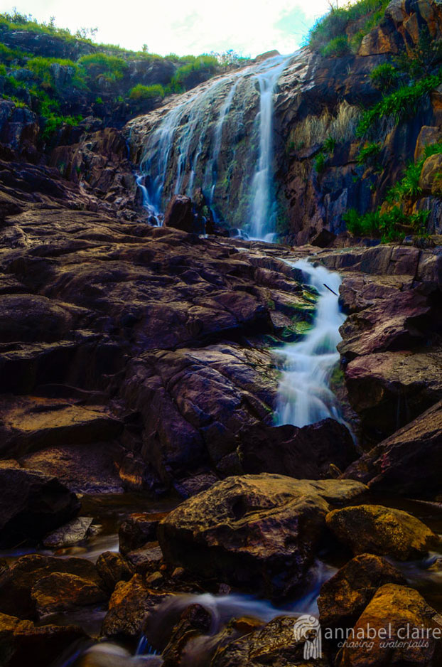
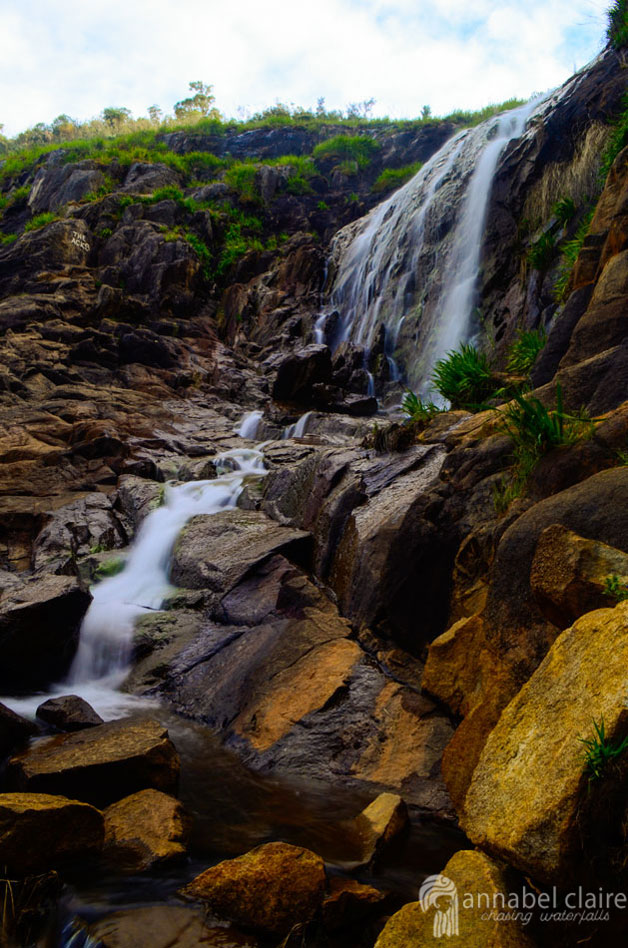
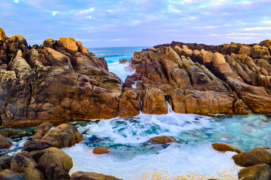
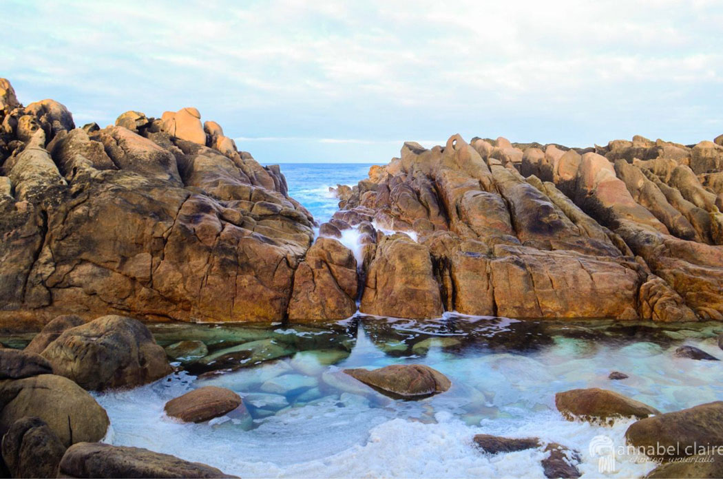
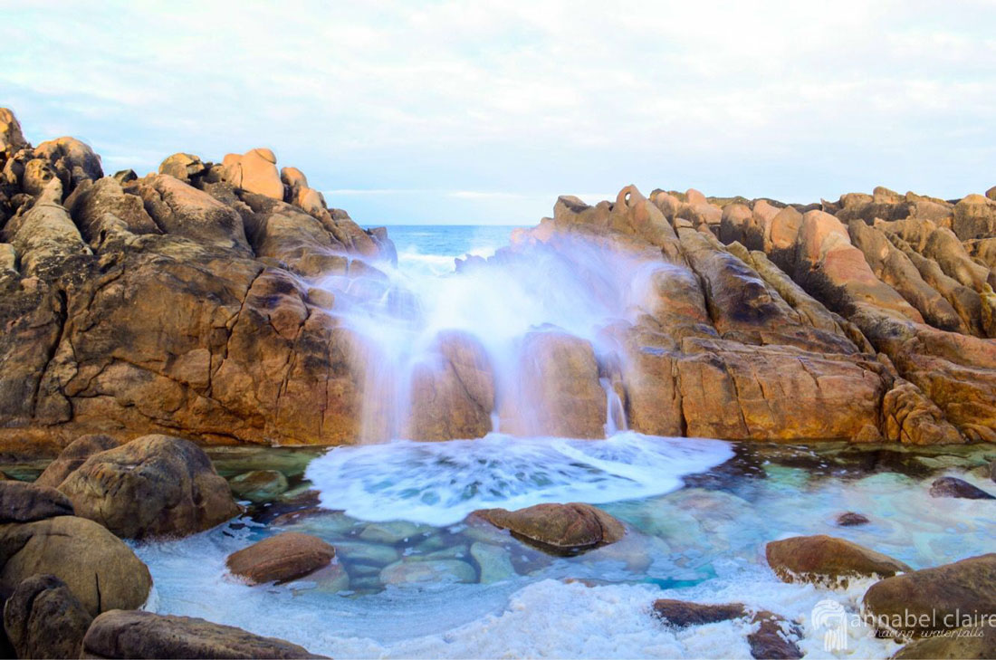
Waterfall Itinerary for A Day in Lorne, Victoria

The most frustrating thing about Googling “hiking tracks” in a particular location is that nobody tells you exactly how it is. There’s no “Waterfall Itinerary for A Day in Lorne.” Sure, there’s plenty of information on each track, their distance, where they begin. But there’s a scarcity of sites that tell you the best order to do them in. Or, which ones can be done in the same day. Luckily, I’ve spent hours researching waterfalls and tracks and testing them to create the best day trip  itineraries I can.

So without further adieu, here is a Waterfall Itinerary for A Day Trip in Lorne that you can follow to a tee. It includes: Erskine Falls, Straw Falls, Splitter Falls, Sheaok Falls & Swallow Cave Falls. Total hiking distance is roughly 5.5kms.

Step 1: Arrival and Accomodation

If you’re like me, you’ll be driving to Lorne from Melbourne, or somewhere else. (I hired a car from Advance Car Rental, but you can also try Car Next Door – click here for $15 off your first trip).

Start your day early and allow enough time to arrive in Lorne by midday at the latest. Lorne is 2hrs and 11 minutes from Melbourne’s CBD. I arrived at 11:30am.

I’d also booked accomodation at the Lorne Coachman Inn, purely because of price and availability. (It was $100 per night, so on my own it was a bit pricey, but for a couple, it’d be great). However, the best option is probably an Airbnb. There are no shortage of beautiful places to stay in Lorne on Airbnb, so definitely have a scout!

Another one of my favourite places to stay in Lorne is the Lorne Foreshore Caravan Park – their Riverview cabins are great value. If in doubt, I always like to look on Hotels.com, or Expedia (I’m affiliated with these sites to receive remuneration if you book, but honestly have found them so helpful) and also Hotel Trivago (whom I’m not affiliated with).

Using a combination of these sites helps me work out what I can get for the best price (Airbnb in Lorne turned out to be the best, but was booked out when I was looking).

Waterfall Itinerary for A Day in Lorne map
Melbourne to Lorne (Google Maps, 2018).

Head straight to your accomodation if you want, to drop off supplies and extra baggage. This is a good time to mention that Lorne only has a Foodworks supermarket, which is very expensive. It’s worth doing a food shop prior to arriving in Lorne to save some extra cash. Anyway, since my check-in wasn’t until after 2pm, I drove straight to my first stop: Erskine Falls.

Erskine Falls are only a 13 minute drive from Lorne’s town center. They are an impressive 30 meter drop into a fern gully. The track begins from the Erskine Falls carpark with the first viewing platform only 80meters away. The base of the falls are 220meters further down some 300-odd steps. Allow 1 and 1/2 hrs return if just visiting Erskine Falls. However, Straw Falls and Splitter Falls can be found further along the riverbank. 

To find them, head back towards the staircase from the lower viewing platform. Turn left down some stairs onto the river bank. Here, you can cross the river (if the water levels are low) to a thin path on the other side.

Click here for more information on finding Erskine Falls and specific directions along the river bank. 

Straw Falls can be found by following the thin, windy track that hugs the Erskine River – away from Erskine Falls. After about 400meters, they appear on the left, cascading down a sheer rock face. You’ll know you’re in the right place because a wooden sign on the rock reads “Straw Falls.” Here, you can turn back the way you came to get to the carpark, or continue on to Splitter Falls.

Click here for more information on finding Straw Falls.

Splitter Falls are another 1.5kms further along the Erskine River. Getting to them requires multiple river crossings. There are also potential obstacles, such as fallen trees and debris, along the track. At times it is tricky to see where the track continues. If you follow the river bank, eventually you’ll find them. This should only be attempted when water levels are low.

However, there is no access to the base of Splitter Falls, and they can be difficult to see through trees and shrub. A friend and I climbed down the steep bank to their base in order to capture the image above. I do not recommend this. If you’re not a crazy waterfall enthusiast like me, giving Splitter Falls a miss won’t ruin your day. 

But if you’re like me, and love to visit the “unvisited” places, click here for more information & instructions.

Step 2: Lunch:

If you started your ErskineStrawSplitter Falls journey at midday, it will be well and truly past lunch time (the whole hike should take roughly 3 – 3 and 1/2 hours. However, I’m sure you indulged on some road-trip snacks during the morning’s drive, and packed some snacks for the trek. In any case, now’s a good opportunity to take a break, refuel and recharge. 

There are plenty of great cafes along Lorne’s main strip (pictured below). Stroll along it and take your pick. Personally, I love Bottle of Milk cafe for the burgers & beers, but you might want to save that one for R&R at the end of the day. I’ll leave that to you.

Waterfall Itinerary for A Day in Lorne map of Lorne cafes
Map of Lorne's Main Strip, Great Ocean Road. (Google Maps, 2018).

Once you’re recharged, it’s time for the next step!

Sheoak Falls are another easy, 10 minute drive from Lorne’s town center. The carpark comes straight off Great Ocean Road (not to be confused with the Sheoak Picnic Area, which is much further away). You can access the falls both from the Great Ocean Road carpark (1km return) and the Sheoak Falls Picnic Area (7km return). Personally, I’m a fan of the quicker option. I’m all for maximising my time, and seeing as much as I can in one day. All without exhausting myself with over 6 hours of hiking.

So, to sum up, drive to the Sheoak carpark and experience the short boardwalk to Sheoak Falls, a beautiful display in an amphitheatre-type gorge. 

Click here for more information on finding Sheoak Falls.

When you visit Sheoak Falls, you’ll notice the track come to a fork. You can head down to the right (the base of Sheoak Falls) or up to the left (to Swallow Cave). This is not signposted. 

Head up to the left after visiting the base of Sheoak Falls and find the first viewing platform, which provides the stunning view pictured above. 

Continue further along the track, which curves around to another viewing platform on the other side (see the edge of the platform in the far right of the above picture). However, this requires a river-crossing which should not be attempted if the water levels are high. 

Click here for more information on Swallow Cave (Upper Sheoak Falls) .

Step 4: Rest & Relaxation

After a big day, it’s time for some you-time. This section of Great Ocean Road has lots of stopping bays. Since it’ll be nearing the day’s end, a great option for some rest and relaxation is to find a spot on the beach or along the coast and watch the sunset.

If that’s not your thing, head back into town and find somewhere to grab a meal and a drink. (Perhaps time to treat-yo-self at Bottle of Milk – burgers, chips and a beer? Don’t mind if I do). You’ll need to regain energy for another big day ahead. Click here for a second day trip itinerary in Lorne.

Quick Facts

Total Hiking Distance5.5km
Total Driving Distance (if from Melbourne)174kms
Total Driving Time (if from Melbourne)2hrs 45 mins
Unsealed RoadsNo 
Average Total Cost for this day (AUD) 1 person $200 
Car Hire Cost (small 3 door automatic with 300kms per day free, hired from Advance Car Rental)$33 per day 
Fuel Cost (for this day trip)doable with 1 tank – roughly $35
Accomodation Cost (per night, 1 double room) $100 
Food and Drink Cost  $30-40
Nearby Towns Skenes Creek, Apollo Bay 
Other Waterfalls in this AreaCora Lynn Cascades, Phantom Falls, Henderson Falls, Won Wondah Falls, Lower Kalimna Falls, Upper Kalimna Falls

Want to subscribe?

Never miss out on a waterfall chase by entering your email below!

Recent Posts

Find me on Facebook

An image of a girl in a kimono and hat looking out to azure blue waters of Black Diamond Lake

Black Diamond Lake, Collie – Western Australia

HOW TO FIND BLACK DIAMOND LAKE & TIPS BEFORE YOU GO

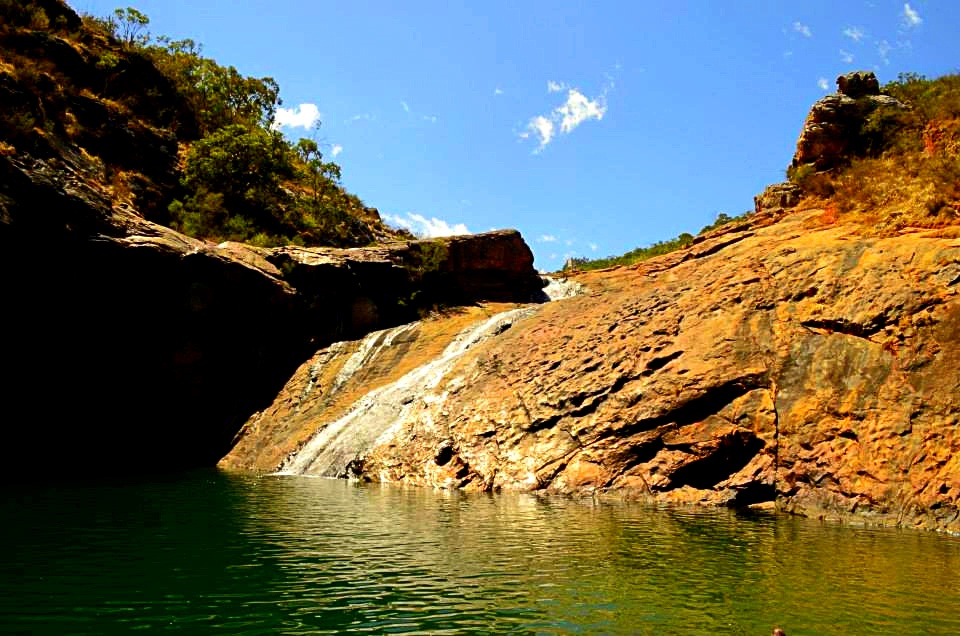
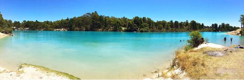
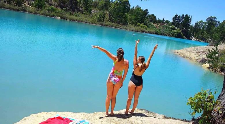
Ever since I saw a photograph of the pristine, bright crystal-blue water of Black Diamond Lake, I wanted to go there.

I mean, look at it.

15991725_10210402590313939_1485170358_o

Friends and I talked about going to Black Diamond Lake, throwing around ideas about road trips and camping trips and the works, but of course, they never actually got put into motion.

While holidaying in Australia’s South West, I decided to change that. I sent my friend Morgan the message – something along the lines of “WE STILL HAVE TO GO TO BLACK DIAMOND LAKE – BEFORE I GO!!!” And Morgz, being the enthusiastic person that she is, said ‘Yep, what about Thursday?’ And that was that.

15978176_10210402591233962_1404490344_n

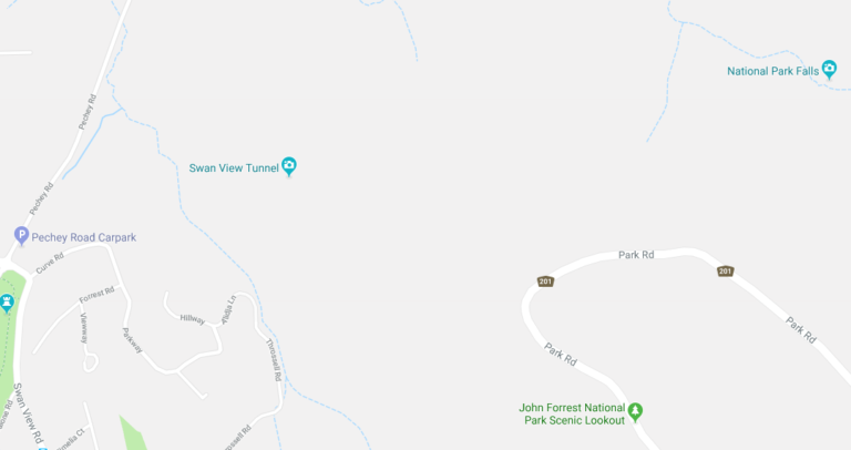
Black Diamond Lake is located in Allanson, a community only 5km or so from the town known as Collie, roughly 190km from Perth.

Morgan drove down from Perth, and I drove up from Busselton. My trip was an hour and a half, while hers 2 hours or so. Either way, the lake isn’t too difficult to get to – Ferguson Road, the road the lake resides by, comes directly off Coalfields Highway, so there’s not a lot of fluffing about in small country-town roads.

Screen Shot 2017-01-16 at 2.26.52 PM.png
Road Map. Black Diamond Lake, Allanson. Google Maps (2017).

I actually visited Black Diamond on the same day I did Barrabup Pool, so I won’t go into the details of the way I went. But if you’re traveling from Perth, take Kwinana Freeway South until it turns into Forrest Highway and eventually continue onto Old Coast Road. Then turn left onto Raymond Road, which you follow until you hit South Western Highway, at which point turn left and then a quick right into Coalfields – and then you’re on your way to Ferguson!

Screen Shot 2017-01-16 at 2.26.27 PM.png
Road Map. Raymond Road to Coalfields Highway. Google Maps (2017).

Once you’ve turned into Ferguson (a right turn onto an unsealed road), keep following for about 600m and you’ll see the first glimpse of the lake. Continue until you come to the first carpark on the right (it will be very obvious). There is lots of parking space there and easy access into the lake.

15967568_10210402591153960_37477852_o

For those that don’t know, Black Diamond was formerly an open cut mine site that ceased operation in the 1950s and has since been filled with water.

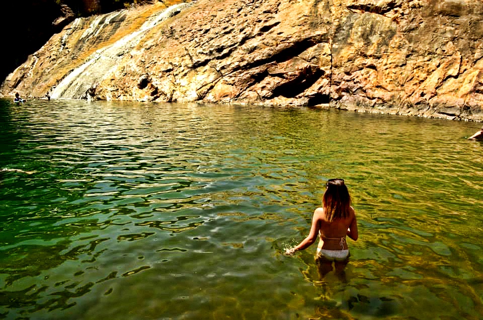
Now it is probably at this point that I should mention the danger of the presence of amoeba in the water. There have been a few warnings issued about the water quality at Black Diamond – all the information you need can be found on the council’s report and also an article by WA today. (FYI, I put my head under the water and I’m still here kicking).
However, it is best to have all the info and make your own educated decision before you go.

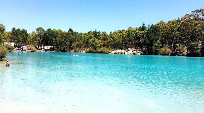
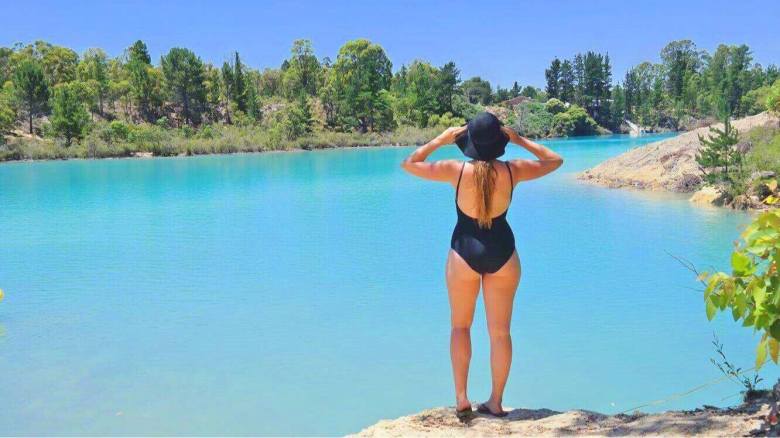
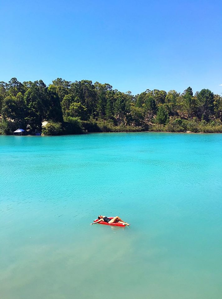
I would recommend going on a really sunny, cloudless day, because this is when the water will look its best, shining the beautiful azure blue colour.

15992014_10210402590713949_464154993_o

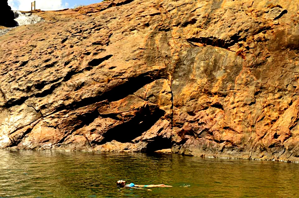
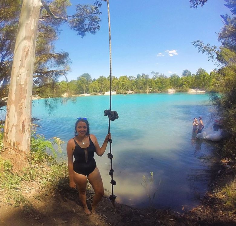
On the opposite side of the lake to the carpark, there’s a rope swing tied to a big tree. We couldn’t help ourselves – we had to have a turn. Though I would advise to jump directly straight and land on your feet, as it is very shallow on either side of this bank (and only if you’re willing to put your head under).

15978508_10210402594674048_505383986_n

In terms of picnicking, the best idea I’ve seen was those who took tarps to use as shades between two cars (generally utes, but you could make do), or small tents, picnic rugs and tables and chairs. There’s not a lot of shade space at the lake, so get creative with your choice of gear and remember to Slip, Slop, Slap!

16010618_10210402597114109_1242520635_o

We made a full day-trip out of being at the lake. Eskies, rugs, you name it. It was such a beautiful setting, even just to sit and observe.

We found a limestone rock to set up our stuff on, rather than being down on the bank with everyone else around us. The rock gave us a higher view of the lake, but not so high that we couldn’t easily enter the water. It was the perfect setting.

15967702_10210402596754100_1343772317_o

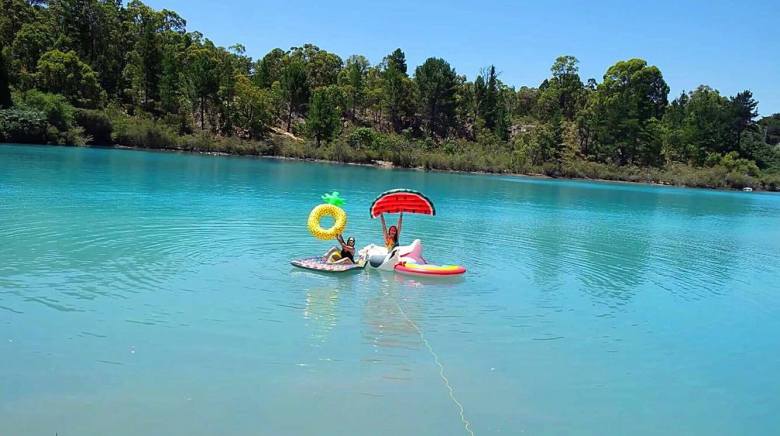
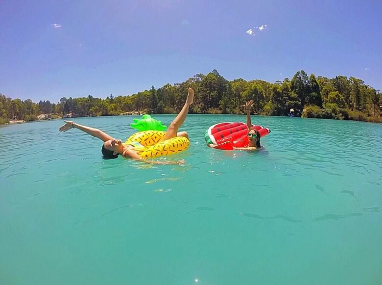
It was a scorching 37 degrees (probably more in direct sunlight) on the day that we went, so we escaped into the cool water, lounging around on blow-up mattresses, watermelons, pineapples and various birds for most of the time.

16009782_10210402595834077_305343485_o

15995502_10210402595314064_919404181_n

15991357_10210402596034082_58684684_o

Would you believe me if  I said that photos don’t even do this place justice?

It is another one of this world’s wonders that is worth seeing – especially when we don’t know how long we will be able to continue to visit, swim and enjoy the lake for.

I’m glad we made the trip.

15978604_10210402591353965_2039035381_n

Quick Facts

Last visitDecember 2018
Best TimeSeptember – March
Start / FinishFerguson Road
Unsealed RoadsYes, good condition can be managed in 2WD.
Walking distanceless than 100m from carpark
Time3hr drive from Perth
DifficultyEasy
FacilitiesNone
Lat & Longn/a
NearbyBarrabup Pool, Collie town
Watercoursen/a
Want to Subscribe?

Never miss out on an adventure by entering your email below!

Kathmandu
Secret location: Gerrigong Falls

Secret or Share? A Contentious Topic

I wanted to talk about a topic that’s rather contentious among ‘adventurers’. It’s something that I have continuously battled with myself, questioning my beliefs and actions for quite some time now. And that is: do we try to keep a place a secret, or do we share it with others?

Secret location: Gerrigong Falls
Gerrigong Falls, Budderoo National Park, NSW

It’s such a contentious issue. And I’m not going to please everyone here. In fact, I’ll probably even piss some people off. That’s just the way life goes, I suppose. But, my blog being what it is and me doing what I do, I feel that I don’t really have a choice other than to comment on the issue.  

So here goes.

Swallow Cave, Upper Sheoak Falls, Great Ocean Road, VIC

It’s no secret that I love adventuring (cough *chasing waterfalls* cough). And recently I’ve had the pleasure of being shown some phenomenal places by some fellow adventurers. However, during the journey it’s become more and more apparent that sharing the details of such locations is ‘strictly prohibited’. Sometimes to the point of beautiful, kind-hearted people getting ferociously bullied online for doing so. Which is not okay. (P.S. Read more about that and the amazing girl who deserves so much better by clicking here).

So why are people so passionate about not sharing the details of a location, to the point where they’ll attack someone else for doing it? It comes down to a number of things.

Belmore Falls, Morton National Park, NSW

First and foremost, it’s about preservation. People want to keep a place as ‘untouched’ as possible – free from litter and people who are likely to disrespect the place and the precious environment. Which I get. It’s a fair point. Ever been to a National Park and noticed a shit-ton of litter everywhere? It’s sad. And sometimes, no matter how hard you try to educate them not to, people will still do the wrong thing.

However, that’s not the only reason. Deep down, some people enjoy the fact that they’re one of the select few people to have visited a place (myself included – it can feel pretty special. Spectacular, even). But it can also feel just as special when you take a deep breath, take it all in and admire a place for what it is (no matter if someone else has been there before you or not).

Person in floatie in Rocky Pool, Gooseberry Hill
Rocky Pool, Gooseberry Hill National Park, WA

And the last reason – and this is the big one – is to prevent ‘Instagrammers’, or people only interested in promoting themselves, or gaining some kind of ‘fame’ from visiting a place, from flocking to a location and overcrowding it. Turning it into something that it isn’t – just a place to get a good photo in the interest of likes or followers. Don’t get me wrong, I love a good photo as much as the next person, but that’s not the only reason to visit a place. And we all know what happens when a place becomes “so Instagrammable.”

Injidup Natural Spa, Yallingup Beach, WA

So now you know the main reasons why there’s a tendency towards secrecy, it’s time to answer the question. Do I tell someone how to get somewhere? Or not?

You see, the whole concept of my blog is to detail EXACTLY how to get to a place. Because, on the one hand, I love to help people discover the amazing places I’ve been (and because at times I wish someone had done the same for me before I visited). But on the other, I understand wanting to keep an element of the mysterious, the secret, the special, within a place and not ruin or destroy it when tourism ultimately takes over. So where does that leave me? Right between a rock and a hard place, if I’m to use a cliché. 

Lincoln's Rock, Blue Mountains National Park, NSW

Here’s where I stand on the issue. (Forewarning, I’m going to be blunt):

If you’re just “doing it for the gram”, you’re doing it wrong.

The whole point of getting outside and visiting an awesome location isn’t about furthering your fame on social media. That’s just a bonus (for some of us).

The way I see it, if someone has been somewhere and posted a photo of it, chances are someone else is going to want to visit that place, too. Isn’t that how it works? If we didn’t explore anywhere, nowhere would be explored. Sounds ridiculous, right? That’s because it is.

Secret or Share? Kelly's Falls
Kelly's Falls, Royal National Park, NSW

When someone posts a photo of an amazing place, it’s likely people are going to try and find it, whether you help them or not. Wouldn’t it be better those people be given the right information so that they don’t hurt themselves? So that they’re educated on why they shouldn’t litter? On why they should respect it?

And, really, who am I to tell you not to go to a place? Who are you to tell me not to? Who am I to post a photo of a location I’ve had the privilege of visiting, and then deny you that same privilege?

No one ‘owns’ these places, and as nice as it is to feel like you’re visiting somewhere untouched, there’s only so long something like that can last for. Did we forget that age-old saying: ‘sharing is caring’?

We are all responsible for this Earth. We all breathe this air, consume the Earth’s resources. It’s up to all of us to look after it – without getting all gun-ho environmental on you because, yes, I use plastic way more than I should and I eat food that may not have been sourced using the most sustainable methods, and sometimes my showers are longer than three minutes. The point is, I’m no Saint. I’m a common human, just like you.

I also understand that this is my opinion and not everyone is going to agree with me. Everyone is entitled to their own opinion, and I respect yours if it differs from mine. I’d even love to hear yours if you’d like to shoot me an email or leave a comment below. BUT – good vibes only here please. 

Secret or Share? Figure 8 Pool
Figure 8 Pool, Royal National Park, NSW

The fact of it is, I love getting outdoors and experiencing nature, and I’m all for adventuring to a new place – whether it’s well known, forgotten, or secret.

As long as a place isn’t private property, you respect it, are properly educated before you go and are going for the right reasons, I see nothing wrong with sharing these wonderful locations Mother Nature has created for us. We all deserve a chance to experience them, and if I can help someone have even a chance at some of the amazing experiences I’ve had – well, I’m bloody well going to help them.

With love,

Annabel Claire

Want to subscribe?

Never miss out on a waterfall chase by entering your email below!

Recent Posts

Find me on Facebook

Top 10 Waterfalls and Swimming Holes to Visit Near Perth - including Black Diamond Lake

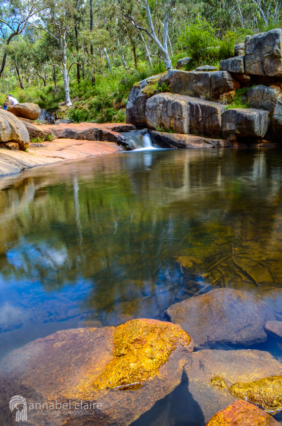
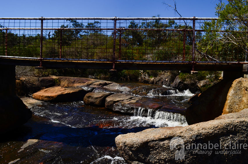
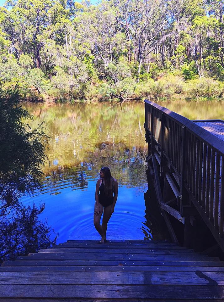
Top 10 Waterfalls and Swimming Holes to Visit Near Perth, Western Australia

WATERFALLS SWIMMING HOLES PERTH

There are many beautiful waterfalls & swimming holes near my hometown of Perth. For those who are lucky enough to live in this isolated city, or passing through during an end-of-summer visit, here are the Top 10 Waterfalls and Swimming Holes to Visit Near Perth!

*Notice how I said near Perth. Some of these require 3+ hours of driving, but most are within 30mins-1hr of Perth’s CBD. Happy adventuring!

Located 55kms South-East of Perth (an hour and 10 minute drive), Serpentine Falls National Park is the perfect spot for a picnic lunch and dip in the (albeit slighty freezing) cold pool. 

Tips: 
Park open 8:30am – 5pm,
usually busy after 10am.
$13 entry for vehicles
(as at October 2017).
Easy, flat walk to falls from carpark (400m).
No unsealed roads.
Facilities include: BBQs, toilets and picnic tables.
Take care: No cliff jumping or diving, deaths have occurred here.

Click here for more information on how to get to these falls.

Lesmurdie Falls may not flow enough to form a pool, but they are a stunning spot to visit in any season. However, the above shot was taken during a very hot day. I had decided to cool off under the fresh spray – and believe me, it was worth it.

The falls are located a mere 30 minute drive from Perth’s CBD, with hiking tracks to a viewing platform (640m return) and the Foot of the Falls trail (2km return).

Tips: 
Bring lots of water: it gets quite warm and staying hydrated is important.
Be prepared for a steep descent/ascent:
a huge part of this trail is downhill, which means uphill on the return.
Stick to the trails:
Lesmurdie Falls drop deep into a valley, so take extra care and don’t deviate.
Facilities: toilets, picnic tables.

Click here for more information on finding these falls & tips once there.

3. Rocky Pool, Gooseberry Hill

Person in floatie in Rocky Pool, Gooseberry Hill

This ‘secret’ gem is located in Gooseberry Hill, Kalamunda National Park. It can be found along a trail that begins from the carpark along Schipp Road in Piesse Brook (pictured below). After about a 2km walk on a wide gravel road, there is a clearing with signs indicating “Rocky Pool.”  

Dirt gravel carparks on Schipp Road

Tips:
Prepare for disappointment: in the crux of summer after no rain, this beauty may be dried up. But if not, it’s a jackpot, which is why it made it into the Top 10 Waterfalls and Swimming Holes to Visit Near Perth. 
There are no facilities at Rocky Pool.

A blog post is coming soon, so stay tuned (you can subscribe to my blog for updates via the homepage, or at the end of this post).

John Forrest National Park falls are a 40 minute drive from Perth’s CBD, and are a lovely surprise after walking through the old Swan View Tunnel. The falls are down in the valley and access to their base requires crossing a small bridge and following the signs that head downhill. This will be along a windy gravel path (last I went this was slightly overgrown, and the base viewing platform was blocked off due to damage). 

Tips:
Getting there: A quick, easy and free way to access the park is by driving to the Pechey Road Carpark in Hovea (map below) and heading along the track that begins there. The Swan View Tunnel will soon appear, which is a good short cut (2km return to the falls), otherwise deviating around it is another option (3km return). 
Bring a torch: if going through the Swan View tunnel, this is a must. 
Wear good shoes: if going through the tunnel, it can sometimes be very wet and impossible to avoid puddles. Shoes with good grip will also help on the gravel paths.

Pechey Road Carpark starting point for Swan View Tunnel & National Park Falls

Number 5 in the Top 10 Waterfalls and Swimming Holes to Visit Near Perth are Hovea Falls, located in John Forrest National Park, approximately 2km further on from the National Park Falls

These falls aren’t really for swimming, but after rain the steady slope that meanders down the hill will provide a stunning landscape. Even a thin flow of water is perfect for laying in, or admiring from the drier rocks. 

Tips:
Take the shortcut: Rather than access Hovea Falls by foot after the John Forrest National Park Tunnel & Falls, a quicker route is to drive to a no-through road called Victoria Road. This is on the other side of the Tavern. Here, there is space to pull over on the side of the road and walk a short distance (roughly 500 meters) to the falls.

National Park Falls and Hovea Falls with Tavern in Between

6. Ellis Brook Valley Reserve, Martin

Photo by @morgshaffs

Personally I’m yet to visit this natural wonder, but I hear it’s a beautiful spot. Often confused with being called “Ellis Brook Valley Reserve” this pool is actually called the ‘Old Barrington Quarry.’ It is found along the Sixty Foot Falls loop trail.  Sixty Foot Falls are only visible when flowing after heavy rain. This means it would be bone-dry in summer, but the quarry is worth the visit.

Tips: 
Directions: Begin from the Valley Head carpark (35 mins from Perth CBD) where there will be signs indicating the walking trails.
Try both viewpoints at the top and bottom of the quarry for a different perspective.

One of my favourite locations is the gorgeous Black Diamond Lake, 5km from the old country town of Collie. Roughly 190kms from Perth, it will take 2hrs and 15 minutes to reach. Ferguson Road, the road the lake resides by, comes directly off Coalfields Highway and is unsealed, but in good condition.  

Tips:
Be aware of the risks: a downside to Black Diamond is the suspected presence of amoeba in the water. There have been a few warnings issued about the water quality at Black Diamond. All relevant information can be found on the council’s report and also in an article by WA today. FYI, I put my head under the water and I’m still here kicking.
Visit on a sunny day:
the lake will look its bluest on a bright, sunny day.
Bring fun floaties: they make for great pictures and something to lay on while enjoying the lake.
Picnic rugs & tarps: to help with comfort. Try hanging tarps between cars, or bring a tent for some extra shade. Pair this with an esky full of delish food & drink and you’re all set!
There are no facilities at Black Diamond Lake. Camping is not permitted.

Click here for more information on visiting Black Diamond Lake.

Another quiet spot is Barrabup Pool in Nannup (if it’s not during a peak camping time).  Located 280kms South of Perth, Nannup is a small country town located inland, though still in the shire of the South West region.  It will take 3hrs by car from Perth’s CBD. 

Tips:
Plan an adventure: while beautiful, the pool isn’t worth the 3hr drive on its own. There are a few other pools nearby on the same St Johns Brook, but try also pairing it with a water-adventure day that maybe includes Black Diamond Lake, Honeymoon Pool, or beaches in the Margaret River Region.
Water activities: canoeing and stand-up paddle boarding are popular here since it’s so calm.
Camping: is permitted at the Barrabup Campground. Cost is $8 per night for adults ($6 concession) and $3 for children (ages 5-16). 
Facilities: toilets, picnic tables, jetty.
The roads are bumpy and unsealed, but 2WD is fine.

Click here for more information on Barrabup Pool.

9. Honeymoon Pool, Worsley

Photo by @morganshaffs

I’m yet to visit Honeymoon Pool in Worsley, but I’ve heard magical things. Located 2hrs and 15 minutes from Perth, the pool is easy to find because it’s a popular camping spot. 

Tips:
Avoid peak times: for a quieter experience.
Camping: Cost is $11 per night per adult ($7 with concession) and $3 for children (ages 5-16).
Facilities: toilets, picnic tables, BBQs.
Access: according to the Parks and Wildlife Service WA, River Road will be closed between Wellington Dam Road and Honeymoon Pool from until the end of March 2018. Access Honeymoon Pool from Wellington Dam Road during this period via Falcon Road and Lennard Drive (one way). Access from Honeymoon Pool to Wellington Dam Road via River Road (south), Pile Road and Falcon Road. 

Last but certainly not least is my favourite spot on Earth, Injidup Natural Spa (AKA Wyadup Rocks) in Yallingup. Located 3 hours South of Perth CBD in the Margaret River Region, it’s still well-worth a visit.

This rock pool is fuelled by the intense crashing of waves from the wild ocean on the other side. These waves ripple over the rocks, creating a waterfall. It’s a beautiful summer location, but I’ve also been here in winter, autumn, spring, at sunrise and sunset, and I can’t seem to fault it. 

Tips: 
Beat the crowds: ever since this spot was listed on SoPerth, people flocked to it like I do when there’s cheese Doritos at a party – quickly and without hesitation. Try visiting at the crack of dawn for some privacy, or while the sun is setting for a spectacular display.
Make the most of it: the Margaret River Region is a beautiful part of WA. Be sure to do some exploring around the beautiful beaches and wineries while in the area.

Click here for more information on Injidup Natural Spa.

And that’s a wrap! The Top 10 Waterfalls and Swimming Holes to Visit Near Perth. Go celebrate the last weekend of summer by exploring some of the beauty that Perth and it’s surrounding regions in WA have to offer.

Want to subscribe?

Never miss out on a waterfall chase by entering your email below!

Recent Posts

Find me on Facebook